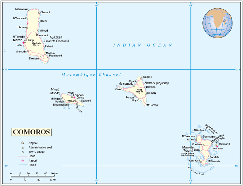
File:Comoros Mayotte.PNG
Appearance

Size of this preview: 784 × 600 pixels. Other resolutions: 314 × 240 pixels | 628 × 480 pixels | 847 × 648 pixels.
Original file (847 × 648 pixels, file size: 70 KB, MIME type: image/png)
File history
Click on a date/time to view the file as it appeared at that time.
| Date/Time | Thumbnail | Dimensions | User | Comment | |
|---|---|---|---|---|---|
| current | 05:04, 26 July 2005 |  | 847 × 648 (70 KB) | Taichi | Map of Comoros and Mayotte Source: http://www.un.org/Depts/Cartographic/map/profile/comoros.pdf About the maps: The United Nations cartographics section claims: :''Unless otherwise noted, the maps included on this web site are produced by the Cartograph |
File usage
The following page uses this file:
Global file usage
The following other wikis use this file:
- Usage on ar.wikipedia.org
- Usage on ast.wikipedia.org
- Usage on cbk-zam.wikipedia.org
- Usage on ceb.wikipedia.org
- Usage on eo.wikipedia.org
- Usage on es.wikipedia.org
- Usage on fr.wikipedia.org
- Usage on gl.wikipedia.org
- Usage on he.wikipedia.org
- Usage on ja.wikipedia.org
- Usage on lfn.wikipedia.org
- Usage on mg.wikipedia.org
- Usage on mt.wikipedia.org
- Usage on pt.wikipedia.org
- Usage on ro.wikipedia.org
- Usage on rue.wikipedia.org
- Usage on ru.wikipedia.org
- Usage on sv.wikipedia.org
- Usage on tr.wikipedia.org
- Usage on uk.wikipedia.org
- Usage on www.wikidata.org
- Usage on zh.wikipedia.org

