
File:Corte Madera California aerial view.jpg

Size of this preview: 800 × 534 pixels. Other resolutions: 320 × 214 pixels | 640 × 427 pixels | 1,024 × 683 pixels | 1,500 × 1,001 pixels.
Original file (1,500 × 1,001 pixels, file size: 807 KB, MIME type: image/jpeg)
| This is a file from the Wikimedia Commons. Information from its description page there is shown below. Commons is a freely licensed media file repository. You can help. |
| Description |
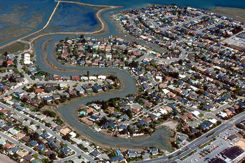
English: Aerial view of the Meadowsweet area of Corte Madera, California, USA. The city lies on the western side of upper San Francisco Bay. San Clemente Creek winds through the neighborhood. Paradise Drive is visible at the bottom of the picture. View is to the northeast.
Coordinates: 37°55′20.21″N 122°30′14.16″W / 37.9222806°N 122.5039333°W |
|||
| Location | Corte Madera, California, USA | |||
| Date | not specified or unknown | |||
| Source |
U.S. Army Corps of Engineers Digital Visual Library Image page Image description page Digital Visual Library home page |
|||
| Author | Robert Campbell, U.S. Army Corps of Engineers | |||
| Permission (Reusing this file) |
|
File history
Click on a date/time to view the file as it appeared at that time.
| Date/Time | Thumbnail | Dimensions | User | Comment | |
|---|---|---|---|---|---|
| current | 01:57, 3 May 2007 | | 1,500 × 1,001 (807 KB) | DanMS | {{Information | Description = {{en|Aerial view of the Meadowsweet area of Corte Madera, California, USA. The city lies on the western side of upper San Francisco Bay. San Clemente Creek winds through the neighborhood. Paradise Drive is visible at the b |
File usage
The following page uses this file:
Global file usage
The following other wikis use this file:
- Usage on ar.wikipedia.org
- Usage on bg.wikipedia.org
- Usage on cs.wikipedia.org
- Usage on es.wikipedia.org
- Usage on fa.wikipedia.org
- Usage on it.wikipedia.org
- Usage on pl.wikipedia.org
- Usage on pt.wikipedia.org
- Usage on sh.wikipedia.org
- Usage on sr.wikipedia.org
- Usage on uz.wikipedia.org