
File:Fort ticonderoga 1759.jpg

Size of this preview: 800 × 522 pixels. Other resolutions: 320 × 209 pixels | 640 × 417 pixels | 1,024 × 668 pixels | 1,280 × 835 pixels | 2,560 × 1,670 pixels | 3,686 × 2,404 pixels.
Original file (3,686 × 2,404 pixels, file size: 1.15 MB, MIME type: image/jpeg)
| This is a file from the Wikimedia Commons. Information from its description page there is shown below. Commons is a freely licensed media file repository. You can help. |
| Description |
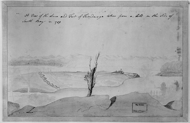
English: A view of the lines and Fort of Tcionderoga [e.g. Ticonderoga] taken from a hill on the side of South Bay in 1759. Topographical drawing shows Fort Ticonderoga, drawn from the South Bay of Lake Champlain in New York state during the French and Indian War. The tents marking military encampment are penciled in. REPOSITORY: Library of Congress Prints and Photographs Division Washington, D.C. 20540 USA. |
||
| Date | |||
| Source |
|
||
| Author | Unknown author |

|
This is a faithful photographic reproduction of a two-dimensional, public domain work of art. The work of art itself is in the public domain for the following reason:
The official position taken by the Wikimedia Foundation is that "faithful reproductions of two-dimensional public domain works of art are public domain".
This photographic reproduction is therefore also considered to be in the public domain in the United States. In other jurisdictions, re-use of this content may be restricted; see Reuse of PD-Art photographs for details. | ||||
File history
Click on a date/time to view the file as it appeared at that time.
| Date/Time | Thumbnail | Dimensions | User | Comment | |
|---|---|---|---|---|---|
| current | 16:36, 5 May 2005 | | 3,686 × 2,404 (1.15 MB) | Sebastian Wallroth | A view of the lines and Fort of Tcionderoga [e.g. Ticonderoga] taken from a hill on the side of South Bay in 1759. Topographical drawing shows Fort Ticonderoga, drawn from the South Bay of Lake Champlain in New York state during the French and Indian War. |
File usage
The following page uses this file:
Global file usage
The following other wikis use this file:
- Usage on da.wikipedia.org
- Usage on de.wikipedia.org
- Usage on fr.wikipedia.org
- Usage on ja.wikipedia.org
- Usage on no.wikipedia.org