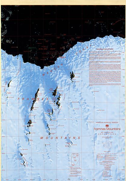
File:Framnes Mountains Satellite Image Map.jpg
Appearance

Size of this preview: 419 × 599 pixels. Other resolutions: 168 × 240 pixels | 335 × 480 pixels | 537 × 768 pixels | 716 × 1,024 pixels | 1,432 × 2,048 pixels | 8,256 × 11,808 pixels.
Original file (8,256 × 11,808 pixels, file size: 18.35 MB, MIME type: image/jpeg)
File history
Click on a date/time to view the file as it appeared at that time.
| Date/Time | Thumbnail | Dimensions | User | Comment | |
|---|---|---|---|---|---|
| current | 16:03, 6 January 2017 |  | 8,256 × 11,808 (18.35 MB) | SteinsplitterBot | Bot: Image rotated by 180° |
| 14:47, 6 January 2017 |  | 8,268 × 11,812 (18.36 MB) | 4ing | =={{int:filedesc}}== {{Information |description={{en|1=Satellite image map of Framnes Mountains, Mac. Robertson Land, Antarctica. This map was produced for the Australian Antarctic Division by AUSLIG (now Geoscience Australia) Commercial, in Australia,... |
File usage
The following 5 pages use this file:
Global file usage
The following other wikis use this file:
- Usage on bg.wikipedia.org
- Usage on ceb.wikipedia.org
- Usage on de.wikipedia.org
- Usage on es.wikipedia.org
- Usage on he.wikipedia.org
- Usage on nn.wikipedia.org
- Usage on www.wikidata.org
