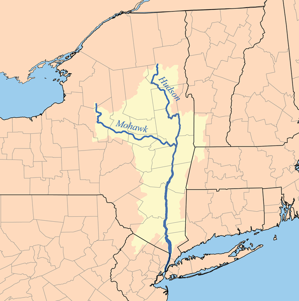
File:Hudsonmap.png
Appearance

Size of this preview: 597 × 600 pixels. Other resolutions: 239 × 240 pixels | 478 × 480 pixels | 1,000 × 1,005 pixels.
Original file (1,000 × 1,005 pixels, file size: 416 KB, MIME type: image/png)
File history
Click on a date/time to view the file as it appeared at that time.
| Date/Time | Thumbnail | Dimensions | User | Comment | |
|---|---|---|---|---|---|
| current | 16:13, 6 July 2012 |  | 1,000 × 1,005 (416 KB) | Kmusser | increased resolution |
| 10:41, 8 April 2012 |  | 279 × 281 (20 KB) | Ras67 | cropped | |
| 19:28, 19 July 2006 |  | 300 × 300 (22 KB) | Kmusser | == Summary == This is a map of the Hudson River Watershed I made using USGS data, includes the Mohawk River. Category:Maps of rivers == Licensing == {{self|cc-by-sa-2. |
File usage
The following 11 pages use this file:
Global file usage
The following other wikis use this file:
- Usage on af.wikipedia.org
- Usage on ar.wikipedia.org
- Usage on arz.wikipedia.org
- Usage on azb.wikipedia.org
- Usage on be.wikipedia.org
- Usage on bg.wikipedia.org
- Usage on cs.wikipedia.org
- Usage on cv.wikipedia.org
- Usage on da.wikipedia.org
- Usage on de.wikipedia.org
- Usage on en.wiktionary.org
- Usage on eo.wikipedia.org
- Usage on es.wikipedia.org
- Usage on et.wikipedia.org
- Usage on fa.wikipedia.org
- Usage on fi.wikipedia.org
- Usage on frr.wikipedia.org
- Usage on fr.wikipedia.org
- Usage on fy.wikipedia.org
- Usage on hu.wikipedia.org
- Usage on hy.wikipedia.org
- Usage on ia.wikipedia.org
- Usage on id.wikipedia.org
- Usage on incubator.wikimedia.org
- Usage on it.wikipedia.org
- Usage on ja.wikipedia.org
- Usage on ko.wikipedia.org
- Usage on la.wikipedia.org
- Usage on lt.wikipedia.org
View more global usage of this file.
