
File:Indre Wijdefjorden National Park map.svg

Size of this PNG preview of this SVG file: 401 × 600 pixels. Other resolutions: 160 × 240 pixels | 321 × 480 pixels | 513 × 768 pixels | 685 × 1,024 pixels | 1,369 × 2,048 pixels | 672 × 1,005 pixels.
Original file (SVG file, nominally 672 × 1,005 pixels, file size: 10.71 MB)
| This is a file from the Wikimedia Commons. Information from its description page there is shown below. Commons is a freely licensed media file repository. You can help. |
| Description |
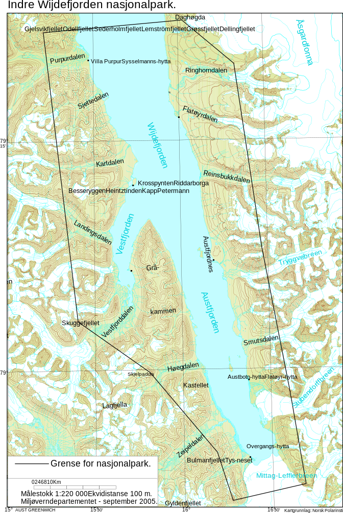
English: Map of Indre Wijdefjorden National Park
Norsk bokmål: Kart over Indre Wijdefjorden nasjonalpark |
|||
| Date | ||||
| Source | http://www.regjeringen.no/upload/kilde/md/prm/2005/0037/ddd/pdfv/256761-indrewijdefjorden_kart_endelig_sept05.pdf | |||
| Author | Norwegian Ministry of the Environment / Miljøverndepartementet | |||
| Permission (Reusing this file) |
|

File history
Click on a date/time to view the file as it appeared at that time.
| Date/Time | Thumbnail | Dimensions | User | Comment | |
|---|---|---|---|---|---|
| current | 15:32, 11 September 2010 | | 672 × 1,005 (10.71 MB) | Arsenikk | {{Information |Description={{en|1=Map of Indre Wijdefjorden National Park}} {{no|1=Kart over Indre Wijdefjorden nasjonalpark}} |Source=http://www.regjeringen.no/upload/kilde/md/prm/2005/0037/ddd/pdfv/256761-indrewijdefjorden_kart_endelig_sept05.pdf |Autho |
File usage
The following 8 pages use this file:
Global file usage
The following other wikis use this file:
- Usage on az.wikipedia.org
- Usage on ca.wikipedia.org
- Usage on da.wikipedia.org
- Usage on de.wikipedia.org
- Usage on en.wikivoyage.org
- Usage on es.wikipedia.org
- Usage on fa.wikipedia.org
- Usage on fr.wikipedia.org
- Usage on he.wikipedia.org
- Usage on hu.wikipedia.org
- Usage on it.wikipedia.org
- Usage on ka.wikipedia.org
- Usage on nl.wikipedia.org
- Usage on nn.wikipedia.org
- Usage on no.wikipedia.org
- Usage on ru.wikipedia.org
- Usage on sl.wikipedia.org
- Usage on uk.wikipedia.org
- Usage on www.wikidata.org
- Usage on zh.wikipedia.org