
File:Kolguyev-txu-oclc-6654394-nr-39-40-3rd-ed.png
Size of this preview: 533 × 599 pixels. Other resolutions: 213 × 240 pixels | 427 × 480 pixels | 683 × 768 pixels | 911 × 1,024 pixels | 1,307 × 1,469 pixels.
Original file (1,307 × 1,469 pixels, file size: 3.18 MB, MIME type: image/png)
| This is a file from the Wikimedia Commons. Information from its description page there is shown below. Commons is a freely licensed media file repository. You can help. |
Summary
| Description |
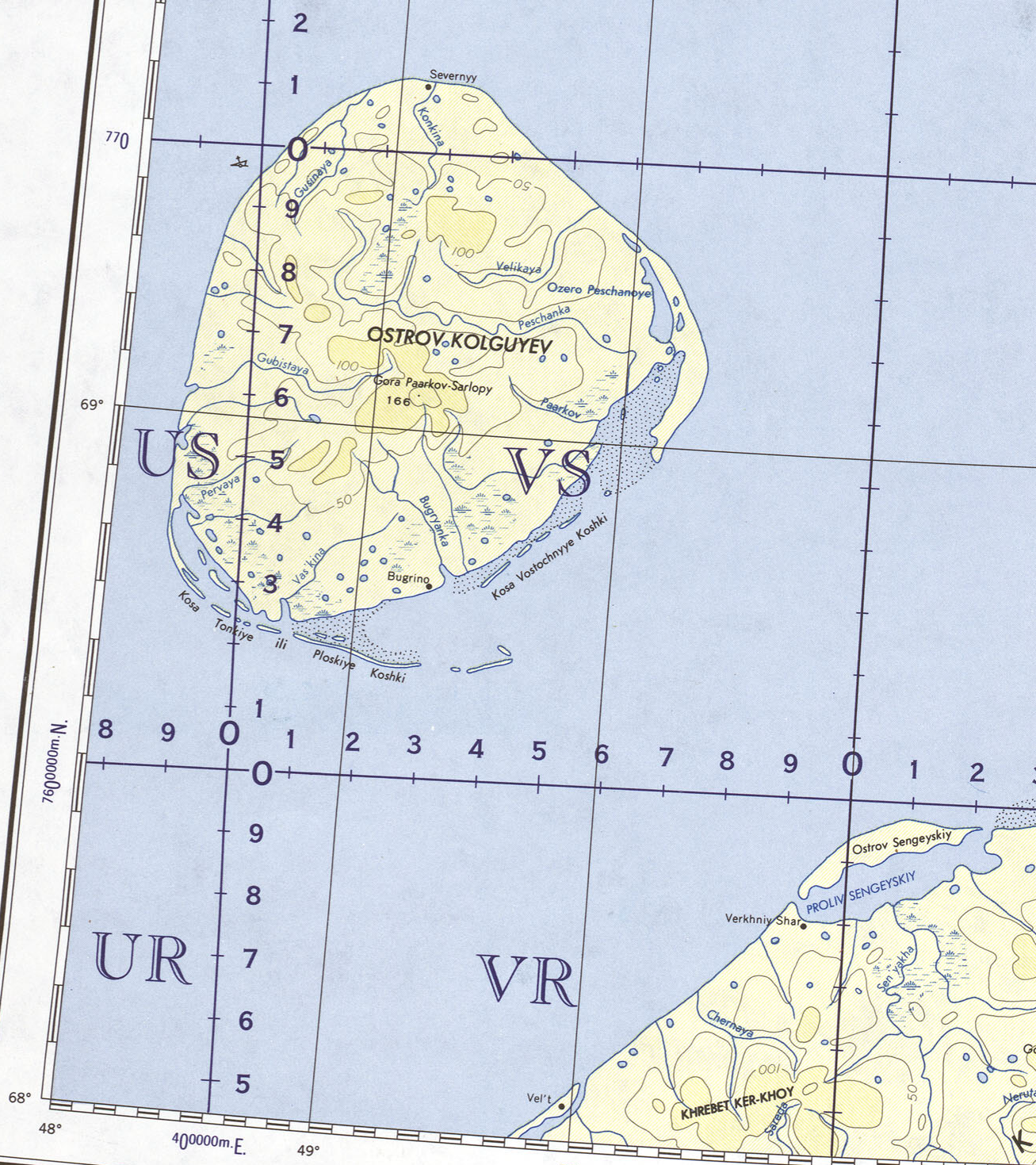
English: International Map of the World 1:000000, part covering Kolguyev Island, Russian Arctic |
| Date | |
| Source | http://www.lib.utexas.edu/maps/imw/txu-oclc-6654394-nr-39-40-3rd-ed.jpg |
| Author | Army Map Service, Corps of Engineers, U.S. Army |
Licensing
This file is a work of a U.S. Army soldier or employee, taken or made as part of that person's official duties. As a work of the U.S. federal government, it is in the public domain in the United States.
|
 |
File history
Click on a date/time to view the file as it appeared at that time.
| Date/Time | Thumbnail | Dimensions | User | Comment | |
|---|---|---|---|---|---|
| current | 09:57, 13 March 2010 | | 1,307 × 1,469 (3.18 MB) | Ratzer | {{Information |Description={{en|1=International Map of the World 1:000000, part covering Kolguyev Island, Russian Arctic}} |Source=http://www.lib.utexas.edu/maps/imw/txu-oclc-6654394-nr-39-40-3rd-ed.jpg |Author=Army Map Service, Corps of Engineers, U.S. A |
File usage
The following page uses this file:
Global file usage
The following other wikis use this file:
- Usage on be.wikipedia.org
- Usage on de.wikipedia.org
- Usage on fa.wikipedia.org
- Usage on fi.wikipedia.org
- Usage on it.wikipedia.org
- Usage on ja.wikipedia.org
- Usage on ko.wikipedia.org
- Usage on pl.wikipedia.org
- Usage on pt.wikipedia.org
- Usage on tr.wikipedia.org