
File:Locator map of Bartlehiem.png
No higher resolution available.
Locator_map_of_Bartlehiem.png (280 × 130 pixels, file size: 8 KB, MIME type: image/png)
| This is a file from the Wikimedia Commons. Information from its description page there is shown below. Commons is a freely licensed media file repository. You can help. |
File history
Click on a date/time to view the file as it appeared at that time.
| Date/Time | Thumbnail | Dimensions | User | Comment | |
|---|---|---|---|---|---|
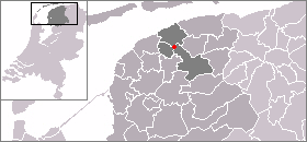
| current | 09:46, 4 March 2007 | | 280 × 130 (8 KB) | SieBot | {{Information |Description=Kaart met de locatie van Bartlehiem, gemaakt uit sjabloon van Wikipedia-gebruiker Mtcv |Source=Originally from [http://nl.wikipedia.org nl.wikipedia]; description page is/was [http://nl.wikipedia.org/w/index.php?title=Image%3AL |
File usage
The following page uses this file:
Global file usage
The following other wikis use this file:
- Usage on eo.wikipedia.org
- Usage on fa.wikipedia.org
- Usage on fr.wikipedia.org
- Usage on www.wikidata.org