
File:Map D A64.svg

Size of this PNG preview of this SVG file: 506 × 600 pixels. Other resolutions: 202 × 240 pixels | 405 × 480 pixels | 648 × 768 pixels | 864 × 1,024 pixels | 1,728 × 2,048 pixels | 1,073 × 1,272 pixels.
Original file (SVG file, nominally 1,073 × 1,272 pixels, file size: 531 KB)
| This is a file from the Wikimedia Commons. Information from its description page there is shown below. Commons is a freely licensed media file repository. You can help. |
File history
Click on a date/time to view the file as it appeared at that time.
| Date/Time | Thumbnail | Dimensions | User | Comment | |
|---|---|---|---|---|---|
| current | 18:26, 2 May 2022 | | 1,073 × 1,272 (531 KB) | NordNordWest | upd |
| 18:00, 27 September 2019 |  | 1,073 × 1,272 (465 KB) | NordNordWest | upd | |
| 17:40, 23 December 2018 |  | 1,073 × 1,272 (467 KB) | NordNordWest | upd | |
| 20:31, 21 January 2018 |  | 1,073 × 1,272 (464 KB) | NJ Giggie | upd | |
| 15:24, 18 October 2012 |  | 1,073 × 1,272 (458 KB) | NordNordWest | upd | |
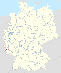
| 20:44, 14 April 2012 |  | 1,073 × 1,272 (499 KB) | NordNordWest | == {{int:filedesc}} == {{Information |Description= {{de|Karte der Bundesautobahn 64 in Deutschland}} {{en|Map of Bundesautobahn 64 in Germany}} |Source={{Own}} |Date={{Date|2012|04|14}} |Author={{U|NordNordWest}} & {{U|Lencer}} |Permission= |other_ver... |
File usage
The following page uses this file:
Global file usage
The following other wikis use this file:
- Usage on de.wikipedia.org
- Usage on de.wikivoyage.org
- Usage on eo.wikipedia.org
- Usage on fr.wikipedia.org
- Usage on hu.wikipedia.org
- Usage on it.wikipedia.org
- Usage on ja.wikipedia.org
- Usage on ko.wikipedia.org
- Usage on lmo.wikipedia.org
- Usage on nl.wikipedia.org
- Usage on no.wikipedia.org
- Usage on pl.wikipedia.org
- Usage on sv.wikipedia.org
- Usage on uk.wikipedia.org
- Usage on www.wikidata.org