
File:Map of Monrovia.png

Size of this preview: 632 × 599 pixels. Other resolutions: 253 × 240 pixels | 506 × 480 pixels | 810 × 768 pixels | 1,080 × 1,024 pixels | 1,876 × 1,779 pixels.
Original file (1,876 × 1,779 pixels, file size: 382 KB, MIME type: image/png)
| This is a file from the Wikimedia Commons. Information from its description page there is shown below. Commons is a freely licensed media file repository. You can help. |
Summary
| Description |
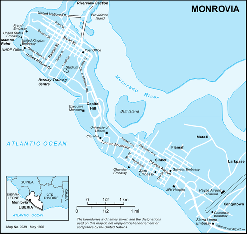
English: Map of Monrovia, capitol of the Republic of Liberia. |
| Date | |
| Source | http://www.un.org/Depts/Cartographic/map/profile/monrovia.pdf |
| Author | United Nations |
In das PNG-Format konvertierte PDF-Datei.
Licensing
This file is licensed under Creative Commons ShareAlike 1.0 License.
Creative Commons has retired this legal tool and does not recommend that it be applied to works.
|
File history
Click on a date/time to view the file as it appeared at that time.
| Date/Time | Thumbnail | Dimensions | User | Comment | |
|---|---|---|---|---|---|
| current | 23:00, 18 November 2010 | | 1,876 × 1,779 (382 KB) | Metilsteiner | {{Information |Description={{en|1=Map of Monrovia, capitol of the Republic of Liberia. }} |Source=http://www.un.org/Depts/Cartographic/map/profile/monrovia.pdf |Author=United Nations |Date=1999-02-12 |Permission= |other_versions= }} In das PNG-Format konv |
File usage
The following 2 pages use this file:
Global file usage
The following other wikis use this file:
- Usage on de.wikipedia.org
- Usage on de.wikivoyage.org
- Usage on ff.wikipedia.org
- Usage on fr.wikipedia.org
- Usage on kbp.wikipedia.org
- Usage on lb.wikipedia.org
- Usage on ml.wikipedia.org
- Usage on pl.wikipedia.org
- Usage on pt.wikipedia.org
- Usage on ru.wikipedia.org
- Usage on vep.wikipedia.org