
File:Mappa storica A8.svg

Size of this PNG preview of this SVG file: 800 × 566 pixels. Other resolutions: 320 × 226 pixels | 640 × 453 pixels | 1,024 × 724 pixels | 1,280 × 905 pixels | 2,560 × 1,810 pixels | 1,052 × 744 pixels.
Original file (SVG file, nominally 1,052 × 744 pixels, file size: 48 KB)
| This is a file from the Wikimedia Commons. Information from its description page there is shown below. Commons is a freely licensed media file repository. You can help. |
Summary
| Description |
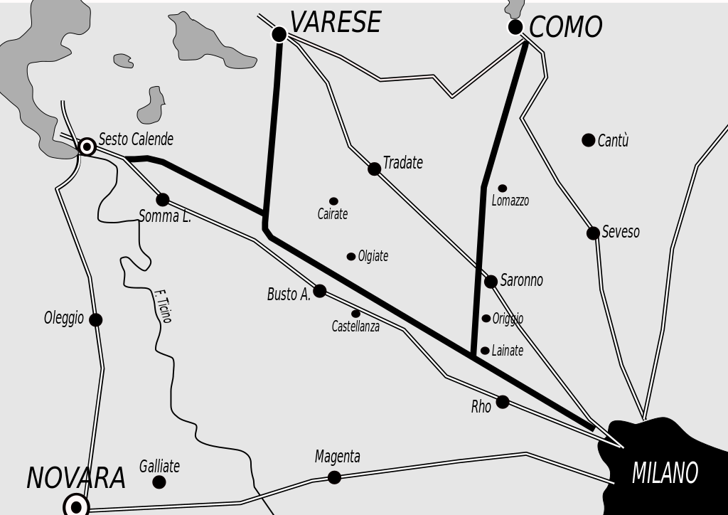
English: Historical map of the original A8 motorway, Italy
Italiano: Mappa storica dell'originale percorso dell'A8 |
| Date | |
| Source | Own work |
| Author | Gigillo83 |
Licensing
I, the copyright holder of this work, hereby publish it under the following licenses:
This file is licensed under the Creative Commons Attribution-Share Alike 3.0 Unported license.
- You are free:
- to share – to copy, distribute and transmit the work
- to remix – to adapt the work
- Under the following conditions:
- attribution – You must give appropriate credit, provide a link to the license, and indicate if changes were made. You may do so in any reasonable manner, but not in any way that suggests the licensor endorses you or your use.
- share alike – If you remix, transform, or build upon the material, you must distribute your contributions under the same or compatible license as the original.

|
Permission is granted to copy, distribute and/or modify this document under the terms of the GNU Free Documentation License, Version 1.2 or any later version published by the Free Software Foundation; with no Invariant Sections, no Front-Cover Texts, and no Back-Cover Texts. A copy of the license is included in the section entitled GNU Free Documentation License. |
You may select the license of your choice.
File history
Click on a date/time to view the file as it appeared at that time.
| Date/Time | Thumbnail | Dimensions | User | Comment | |
|---|---|---|---|---|---|
| current | 18:59, 24 September 2009 | | 1,052 × 744 (48 KB) | Gigillo83 | Inserimento nomi località |
| 18:47, 24 September 2009 |  | 1,052 × 744 (51 KB) | Gigillo83 | {{Information |Description={{en|1=Historical map of the original A8 motorway, Italy}} {{it|1=Mappa storica dell'originale percorso dell'A8}} |Source=Own work by uploader |Author=Gigillo83 |Date=24/09/2009 |Permission= |other_versions= } |
File usage
The following 6 pages use this file:
Global file usage
The following other wikis use this file:
- Usage on ca.wikipedia.org
- Usage on de.wikipedia.org
- Usage on fr.wikipedia.org
- Usage on it.wikipedia.org
- Usage on ja.wikipedia.org
- Usage on lmo.wikipedia.org
- Usage on ms.wikipedia.org
- Usage on nl.wikipedia.org
- Usage on pt.wikipedia.org
- Usage on ro.wikipedia.org
- Usage on ru.wikipedia.org
- Usage on sk.wikipedia.org
- Usage on sr.wikipedia.org
- Usage on sv.wikipedia.org
- Usage on th.wikipedia.org
- Usage on uk.wikipedia.org
- Usage on vi.wikipedia.org