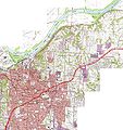
File:OsageTrail Independence Topo 1980red.JPG
Appearance

Size of this preview: 564 × 600 pixels. Other resolutions: 226 × 240 pixels | 452 × 480 pixels | 722 × 768 pixels | 963 × 1,024 pixels | 1,927 × 2,048 pixels | 3,188 × 3,389 pixels.
Original file (3,188 × 3,389 pixels, file size: 3.07 MB, MIME type: image/jpeg)
File history
Click on a date/time to view the file as it appeared at that time.
| Date/Time | Thumbnail | Dimensions | User | Comment | |
|---|---|---|---|---|---|
| current | 05:52, 7 August 2010 |  | 3,188 × 3,389 (3.07 MB) | EGDJ | {{Information |Description={{en|1=Topographical map of much of Independence, Missouri, showing roughly the route of the ancient "Great Osage [Indian] Trail" through the region. The trail originates near central Missouri, Boonville and Franklin, Missouri, |
File usage
The following page uses this file:

