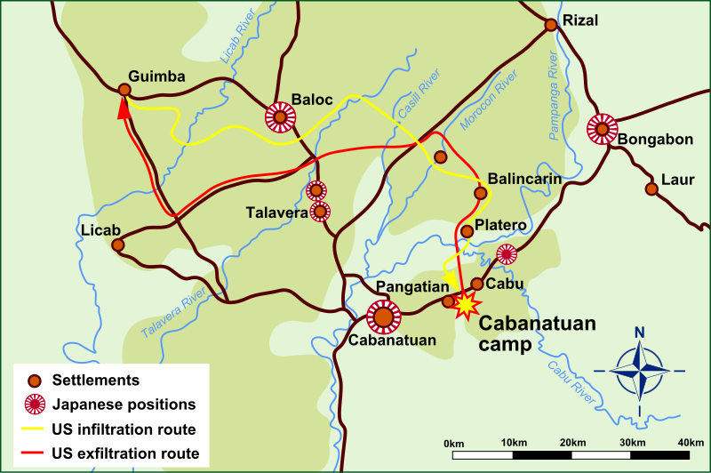
File:Route map of Raid at Cabanatuan.svg
Appearance

Size of this PNG preview of this SVG file: 800 × 532 pixels. Other resolutions: 320 × 213 pixels | 640 × 425 pixels | 1,024 × 681 pixels | 1,280 × 851 pixels | 2,560 × 1,702 pixels | 1,652 × 1,098 pixels.
Original file (SVG file, nominally 1,652 × 1,098 pixels, file size: 317 KB)
File history
Click on a date/time to view the file as it appeared at that time.
| Date/Time | Thumbnail | Dimensions | User | Comment | |
|---|---|---|---|---|---|
| current | 23:04, 12 June 2010 |  | 1,652 × 1,098 (317 KB) | Jappalang | Converted text to path |
| 23:03, 12 June 2010 |  | 1,652 × 1,098 (117 KB) | Jappalang | {{Information |Description=Map of the routes taken by the US Rangers in their Raid at Cabanatuan |Source=* base maps: ND 51-1 Tarlac and ND 51-2 Laur at http://www.lib.utexas.edu/maps/ams/philippines/ (US Army) * route informati |
File usage
The following 2 pages use this file:
Global file usage
The following other wikis use this file:
- Usage on hu.wikipedia.org
- Usage on it.wikipedia.org
- Usage on pl.wikipedia.org
- Usage on ru.wikipedia.org
- Usage on tl.wikipedia.org
