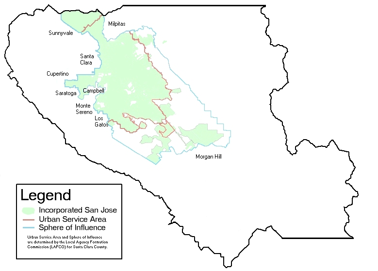
File:SanJoseMapWithLAFCOandAdjacentCities.png
Appearance
SanJoseMapWithLAFCOandAdjacentCities.png (779 × 559 pixels, file size: 87 KB, MIME type: image/png)
| Description |
SanJoseMapWithLAFCOandAdjacentCities. | ||
|---|---|---|---|
| Source |
From US Census Bureau public domain map, with modifcation , Uploader releases edits as public domain, as well. | ||
| Date | |||
| Author |
| ||
| Permission (Reusing this file) |
See below.
|
| This image is a work of a United States Census Bureau employee, taken or made as part of that person's official duties. As a work of the U.S. federal government, the image is in the public domain in the United States. |  |
| This image was uploaded in the PNG, GIF or other lossless image format. However, it contains visible lossy compression artifacts. These artifacts may have come from the JPEG format or from saving a colorful image in the GIF format instead of the PNG format. If possible, please upload a PNG or SVG version of this image, derived from a non-lossy source so that it doesn't contain any compression artifacts (or with existing artifacts removed). After doing so, please replace all instances of the artifacted version throughout Wikipedia (noted under the "File links" header), tag the old version with {{obsolete|NewImage.ext}}, and remove this tag. For more information, see Wikipedia:Preparing images for upload. |
History of Image:SanJoseMapWithLAFCOandAdjacentCities.jpg
[edit]- 2006-04-18T15:54:36Z Bkell (Talk | contribs) ({{badJPEG}})
- 2005-02-09T19:30:23Z Niteowlneils (Talk | contribs) ({{PD-USGov}} {{PD}}From US Census Bureau public domain map. I release my edits public domain, as well.)
 | This file is a candidate to be copied to Wikimedia Commons.
Any user may perform this transfer; refer to Wikipedia:Moving files to Commons for details. If this file has problems with attribution, copyright, or is otherwise ineligible for Commons, then remove this tag and DO NOT transfer it; repeat violators may be blocked from editing. Other Instructions
| ||
| |||
File history
Click on a date/time to view the file as it appeared at that time.
| Date/Time | Thumbnail | Dimensions | User | Comment | |
|---|---|---|---|---|---|
| current | 09:42, 22 July 2008 |  | 779 × 559 (87 KB) | 718 Bot (talk | contribs) | {{PD-USGov}} {{PD}}From US Census Bureau public domain map. I release my edits public domain, as well. {{artifacts}} ==History of Image:SanJoseMapWithLAFCOandAdjacentCities.jpg== *2006-04-18T15:54:36Z Bkell (Talk | [[S |
You cannot overwrite this file.
File usage
The following page uses this file:

