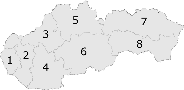
File:Slovakiakrajenumbers.png
Appearance
Slovakiakrajenumbers.png (641 × 313 pixels, file size: 14 KB, MIME type: image/png)
File history
Click on a date/time to view the file as it appeared at that time.
| Date/Time | Thumbnail | Dimensions | User | Comment | |
|---|---|---|---|---|---|
| current | 16:54, 5 April 2007 |  | 641 × 313 (14 KB) | Helix84 | transparent background, optipng |
| 12:11, 24 April 2005 |  | 641 × 313 (38 KB) | Domie~commonswiki | Kraje of Slovakia with numbers {{GFDL}} Category:Maps of Slovakia |
File usage
The following 7 pages use this file:
Global file usage
The following other wikis use this file:
- Usage on an.wikipedia.org
- Usage on ast.wikipedia.org
- Usage on ba.wikipedia.org
- Usage on br.wikipedia.org
- Usage on ca.wikipedia.org
- Usage on da.wikipedia.org
- Usage on de.wikipedia.org
- Usage on eo.wikipedia.org
- Palárikovo
- Tvrdošovce
- Jasová
- Bajtava
- Bánov (distrikto Nové Zámky)
- Bardoňovo
- Trávnica
- Bruty
- Podhájska
- Mužla
- Chľaba
- Leľa
- Salka
- Malá nad Hronom
- Bíňa
- Branovo
- Černík
- Dedinka
- Hul
- Jatov
- Mojzesovo
- Nová Vieska
- Pavlová
- Pozba
- Semerovo
- Rastislavice
- Vlkas
- Radava
- Dolný Ohaj
- Kmeťovo
- Ľubá
- Maňa
- Michal nad Žitavou
- Úľany nad Žitavou
- Sikenička
- Ŝablono:Klakmapo de regionoj de Slovakio
- Usage on es.wikipedia.org
- Usage on eu.wikipedia.org
View more global usage of this file.


