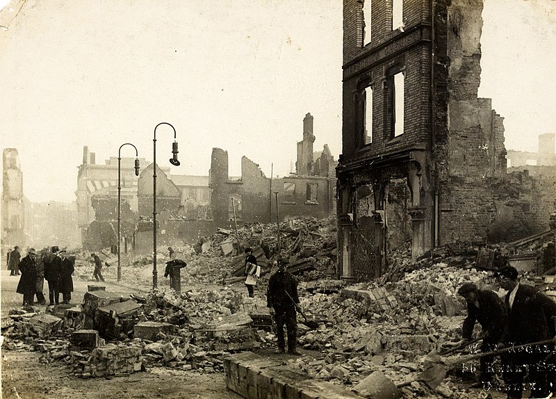
File:The Burning of Cork (9713428703).jpg
Appearance

Size of this preview: 800 × 574 pixels. Other resolutions: 320 × 230 pixels | 640 × 459 pixels | 1,024 × 735 pixels | 1,280 × 919 pixels | 1,978 × 1,420 pixels.
Original file (1,978 × 1,420 pixels, file size: 1.06 MB, MIME type: image/jpeg)
File history
Click on a date/time to view the file as it appeared at that time.
| Date/Time | Thumbnail | Dimensions | User | Comment | |
|---|---|---|---|---|---|
| current | 19:39, 7 December 2019 |  | 1,978 × 1,420 (1.06 MB) | Holly Cheng | Cropped 1 % horizontally, 1 % vertically using CropTool with precise mode. |
| 15:59, 11 September 2013 |  | 2,000 × 1,431 (1.03 MB) | File Upload Bot (Magnus Manske) | Transferred from Flickr by User:guliolopez |
File usage
The following 13 pages use this file:
- Auxiliary Division
- Burning of Cork
- Cork (city)
- Cork Premier Senior Football Championship
- Cork Premier Senior Hurling Championship
- December 1920
- History of Cork
- Irish War of Independence
- Timeline of the Irish War of Independence
- Wikipedia:Main Page history/2019 December 11
- Wikipedia:Main Page history/2020 December 11
- Wikipedia:Main Page history/2020 December 11b
- Wikipedia:Selected anniversaries/December 11
Global file usage
The following other wikis use this file:
- Usage on az.wikipedia.org
- Usage on ba.wikipedia.org
- Usage on cs.wikipedia.org
- Usage on es.wikipedia.org
- Usage on fr.wikipedia.org
- Usage on ga.wikipedia.org
- Usage on he.wikipedia.org
- Usage on hy.wikipedia.org
- Usage on ja.wikipedia.org
- Usage on ko.wikipedia.org
- Usage on nl.wikipedia.org
- Usage on no.wikipedia.org
- Usage on pl.wikipedia.org
- Usage on pt.wikipedia.org
- Usage on ro.wikipedia.org
- Usage on ru.wikipedia.org
- Usage on vls.wikipedia.org
- Usage on www.wikidata.org

