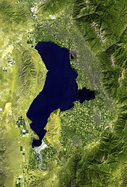
File:Utah Lake prove map.jpg
Appearance

Size of this preview: 407 × 599 pixels. Other resolutions: 163 × 240 pixels | 580 × 853 pixels.
Original file (580 × 853 pixels, file size: 99 KB, MIME type: image/jpeg)
File history
Click on a date/time to view the file as it appeared at that time.
| Date/Time | Thumbnail | Dimensions | User | Comment | |
|---|---|---|---|---|---|
| current | 19:21, 22 February 2009 |  | 580 × 853 (99 KB) | Cropbot | upload cropped version, operated by User:Finavon. Summary: caption/border cropped |
| 03:37, 22 October 2006 |  | 671 × 1,000 (112 KB) | Rolandc73 | {{Information |Description=Imagery by NASA and/or the US Geological Survey. Processed by Terra Prints Inc. Satellite image of Utah Lake and Provo, Utah |Source=http://www.terraprints.com |Date=2006-10-21 |Author=Terra Prints Inc. |Permission=Own work, sha |
File usage
The following 2 pages use this file:
Global file usage
The following other wikis use this file:
- Usage on arz.wikipedia.org
- Usage on ceb.wikipedia.org
- Usage on de.wikipedia.org
- Usage on es.wikipedia.org
- Usage on fa.wikipedia.org
- Usage on fi.wikipedia.org
- Usage on fr.wikipedia.org
- Usage on it.wikipedia.org
- Usage on lld.wikipedia.org
- Usage on ru.wikipedia.org
- Usage on www.wikidata.org
