
U.S. Route 285 in Colorado
 U.S. Highway 285 | ||||
|---|---|---|---|---|
 US 285 highlighted in red | ||||
| Route information | ||||
| Auxiliary route of US 85 | ||||
| Maintained by CDOT | ||||
| Length | 263.87 mi[1] (424.66 km) | |||
| Major junctions | ||||
| South end | ||||
| ||||
| North end | ||||
| Location | ||||
| Country | United States | |||
| State | Colorado | |||
| Counties | Conejos, Alamosa, Rio Grande, Saguache, Chaffee, Park, Jefferson, Arapahoe, Denver | |||
| Highway system | ||||
| ||||
| ||||
U.S. Route 285 (US 285) is the section north-south highway in Colorado that starts at the New Mexico state line and ends at I-25, US 87, and SH 30 in Denver.
Route description
[edit]
Heading north from the Colorado border, US 285 passes through the main part of the San Luis Valley, eventually reaching Alamosa. As the highway heads north, it begins to ascend to the northern end of the valley and eventually climbs over Poncha Pass, elevation 9,012 feet (2,747 m), and drops sharply down the other side into the Arkansas River Valley.
The highway brushes Salida and follows the Arkansas River north up the valley, then takes a sharp eastward turn just before the small town of Buena Vista. 285 then climbs over Trout Creek Pass, elevation 9,346 feet (2,849 m), and enters the high-altitude South Park basin.
A few miles north, the highway passes through Fairplay and the historic South Park City site, then reaches its highest elevation: 10,051 feet (3,064 m), at the summit of Red Hill Pass. US 285 then leaves the South Park basin and climbs over Kenosha Pass, elevation 10,001 feet (3,048 m), and skirts the south side of the Mount Evans massif as it descends its way through the foothills range towards Denver.
As the highway leaves the Rocky Mountains and reaches Denver's southwest suburbs, it becomes Hampden Avenue, an important artery in the south Denver metro area, then reaches its northern terminus at I-25. The high speed, dual-carriageway segment of US 285 that aligns with Hampden Avenue in the grid system is locally known as the Hampden Avenue Freeway.
On March 14, 2008 both houses of the Colorado legislature, in a unanimous vote, named the section between Kenosha Pass and C-470 the Ralph Carr Memorial Highway.[2][3]
History
[edit]The short segment between US 50 at Salida and US 24 at Buena Vista closely parallels the original U.S. Route 650,[4] which was designated in 1926, but eliminated in 1936 when US 285 was commissioned along its present extent from Sanderson to Denver, mostly replacing state-numbered highways.
Between Bailey and Como, US 285 mostly follows the route of the Denver, South Park and Pacific Railroad, part of the original narrow gauge transcontinental railroad.
Gallery
[edit]-
 View of South Park along U.S. Highway 285 looking east toward the Front Range
 -
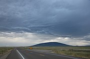 San Antonio Mountain in New Mexico, as seen from the Colorado side of the NM-CO state line on US 285
 -
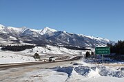 U.S. 285 entering Saguache County from the north


Junction list
[edit]All exits are unnumbered.
| County | Location | mi[1] | km | Destinations | Notes |
|---|---|---|---|---|---|
| Conejos | | 0.000 | 0.000 | Continuation into New Mexico | |
| Antonito | 5.200 | 8.369 | South end of SH 17 concurrency | ||
| Romeo | 12.707 | 20.450 | |||
| La Jara | 19.817 | 31.892 | |||
| 20.418 | 32.860 | ||||
| Alamosa | Estrella | 26.829 | 43.177 | ||
| | 31.257 | 50.303 | |||
| Alamosa | 34.102 | 54.882 | 6th St. is a one-way street, outbound access only; north end of SH 17 concurrency; south end of US 160 concurrency | ||
| 34.175 | 54.999 | Main St. is a one-way street, inbound access only; no southbound access to Main St. | |||
| Rio Grande | Monte Vista | 51.159 | 82.332 | North end of US 160 concurrency | |
| Rio Grande–Saguache county line | | 62.904 | 101.234 | ||
| Saguache | Saguache | 86.290 | 138.870 | ||
| Villa Grove | 100.518 | 161.768 | |||
| Chaffee | Poncha Springs | 126.480 | 203.550 | South end of US 50 concurrency | |
| 126.853 | 204.150 | North end of US 50 concurrency | |||
| | 133.883 | 215.464 | |||
| Johnson Village | 148.065 | 238.288 | South end of US 24 concurrency | ||
| Park | | 161.789 | 260.374 | North end of US 24 concurrency | |
| Fairplay | 181.971 | 292.854 | South end of SH 9 concurrency | ||
| 182.989 | 294.492 | North end of SH 9 concurrency | |||
| | 224.537 | 361.357 | Interchange | ||
| Jefferson | | 231.000 | 371.758 | Elk Creek Road – Shaffers Crossing | Interchange |
| Conifer | 235.316 | 378.704 | Foxton Road / Kennedy Gulch Road | Interchange | |
| 235.945 | 379.717 | Right-in/right-out interchange; CR 73 is former SH 73 | |||
| Main Street | Interchange; northbound exit only | ||||
| Aspen Park | 236.659 | 380.866 | Light Lane Conifer Town Center Parkway | Northbound signage; right-in/right-out interchange Southbound signage; interchange | |
| 237.062 | 381.514 | Main Street / Conifer Road Barkley Road | Northbound signage; right-in/right-out interchange Southbound signage; right-in/right-out interchange | ||
| 237.794 | 382.692 | Meyer Parkway / Conifer Road – Aspen Park | Right-in/right-out interchange | ||
| | 238.877 | 384.435 | South Turkey Creek Road | Interchange | |
| | 244.121 | 392.875 | North Turkey Creek Road – Tinytown | Interchange | |
| Indian Hills | 246.167 | 396.167 | Parmalee Gulch Road | Partial interchange | |
| | 248.443 | 399.830 | South end of freeway, western terminus of SH-8 | ||
| | 250.082 | 402.468 | Cloverleaf interchange; split into separate east (to I-25) and west (to I-70) exits; SH 470 exits 5A-B | ||
| Lakewood | 252.052 | 405.638 | Simms Street | ||
| 253.512 | 407.988 | Southern terminus of SH 391 | |||
| 255.034 | 410.437 | ||||
| City and County of Denver | 256.547 | 412.872 | North end of freeway, southern terminus of SH-95 | ||
| Arapahoe | Sheridan | 258.063 | 415.312 | Interchange | |
| 258.41 | 415.87 | Bryant Street | Right-in/right-out interchange; northbound entrance and exit only | ||
| 259.326 | 417.345 | Interchange; split into separate north and south exits southbound | |||
| Englewood | 260.167 | 418.698 | Broadway | Interchange; former SH 75 | |
| 261.716 | 421.191 | Northern Terminus of SH 177 | |||
| Arapahoe–Denver county line | Englewood–Denver line | 262.688 | 422.755 | Southern Terminus of SH-2 | |
| City and County of Denver | 263.874 | 424.664 | Northern terminus of US 285; I-25 exit 201; highway continues east as SH 30 (Hampden Ave.) | ||
1.000 mi = 1.609 km; 1.000 km = 0.621 mi
| |||||
References
[edit]- ^ a b "Highway Data". OTIS - Online Transportation Information System. Colorado DOT. Archived from the original on September 10, 2012. Retrieved September 1, 2017.
- ^ "Get your car ready for Carr highway | Politics West". www.politicswest.com. Archived from the original on July 15, 2011. Retrieved January 17, 2022.
- ^ "Colorado renames highway to honor Gov. Ralph Carr - Asiaxpress.com - News". Asiaxpress.com. March 17, 2008. Retrieved November 22, 2013.
- ^ Sanderson, Dale. "End of US highway 650". US Ends .com. Retrieved October 21, 2014.
External links
[edit] Media related to U.S. Route 285 in Colorado at Wikimedia Commons
- U.S. Route 285
- U.S. Highways in Colorado
- Transportation in Conejos County, Colorado
- Transportation in Alamosa County, Colorado
- Transportation in Rio Grande County, Colorado
- Transportation in Saguache County, Colorado
- Transportation in Chaffee County, Colorado
- Transportation in Park County, Colorado
- Transportation in Jefferson County, Colorado
- Transportation in Arapahoe County, Colorado
- Transportation in Denver