Carmel Point
Carmel Point
Point Loeb Charles King Van Riper Reamer's Point | |
|---|---|
From top, left to right: Scenic Road, Edward G. Kuster's House; Tor House; Butterfly House; Rock formation; Carmel River Beach | |
 | |
| Coordinates: 36°32′37″N 121°55′59″W / 36.54361°N 121.93306°W | |
| Country | United States |
| State | California |
| County | Monterey County |
| Elevation | 489 ft (149 m) ft (11 m) |
| Time zone | UTC-8 (PST) |
| • Summer (DST) | UTC-7 (PDT) |
| GNIS feature ID | 254713 |
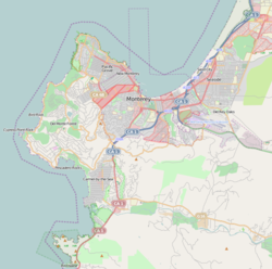
Carmel Point also known as the Point and formerly called Point Loeb and Reamer's Point, is an unincorporated community in Monterey County, California, United States. It is a cape located at the southern city limits of Carmel-by-the-Sea and offers views of Carmel Bay, the mouth of Carmel River, and Point Lobos.[1] Carmel Point was one of three major land developments adjacent to the Carmel city limits between 1922 and 1925. The other two were Hatton Fields, 233 acres (94 ha) between the eastern town limit and Highway 1, and Carmel Woods, 125 acres (51 ha) tract on the north side.[2]
History
[edit]The Carmel Point began with the Rumsen Ohlone Native American tribe, who inhabited the area in the 6th-century.[3] The Spanish explorers and missionaries arrived in the late 18th century and erected, within the Ohlone region, the Mission San Carlos Borroméo de Carmelo (founded in 1770). In 1834, the Mexican land grant ranchos took over the mission land and property. In 1848, Mexico ceded to California as a result of the Mexican–American War.[4]
Geography
[edit]The Carmel Point land is hilly to the east, but flat to the west, which is closest to the Carmel Bay. The highest point in the vicinity is 1,768.37 ft (539.00 m) high and is 18.7 ft (5.7 m) southeast of Carmel Point. There are about 23 people per square kilometer in Carmel Point's relatively small population. The nearest larger town is Seaside, California, which is 6.46 mi (10.40 km) northeast of Carmel Point.[5]
Climate
[edit]| Climate data for Carmel Point | |||||||||||||
|---|---|---|---|---|---|---|---|---|---|---|---|---|---|
| Month | Jan | Feb | Mar | Apr | May | Jun | Jul | Aug | Sep | Oct | Nov | Dec | Year |
| Mean daily maximum °F (°C) | 60.1 (15.6) |
61.0 (16.1) |
64.0 (17.8) |
64.9 (18.3) |
66.9 (19.4) |
68.0 (20.0) |
70.0 (21.1) |
71.1 (21.7) |
70.0 (21.1) |
64.0 (17.8) |
62.1 (16.7) |
60.1 (15.6) |
65.1 (18.4) |
| Mean daily minimum °F (°C) | 43.0 (6.1) |
45.0 (7.2) |
46.9 (8.3) |
48.0 (8.9) |
50.0 (10.0) |
52.0 (11.1) |
53.1 (11.7) |
53.1 (11.7) |
51.1 (10.6) |
46.9 (8.3) |
46.0 (7.8) |
43.0 (6.1) |
48.2 (9.0) |
| Average precipitation inches (mm) | 4.19 (106) |
3.75 (95) |
3.53 (90) |
1.48 (38) |
0.50 (13) |
0.20 (5.1) |
0.09 (2.3) |
0.11 (2.8) |
0.28 (7.1) |
1.06 (27) |
2.43 (62) |
2.73 (69) |
20.35 (517) |
| Source: [6] | |||||||||||||
See also
[edit]- List of places in California
- Timeline of Carmel-by-the-Sea, California
- Historic Homes in Carmel Point
References
[edit]- ^ Geonameslink 254713 Carmel Point at Geonames.org (cc-by);post updated 2022-07-17
- ^ "Outlands In The Eighty Acres". United States Department of Interior National Park Service. February 21, 1989. Retrieved October 18, 2022.
- ^ Henson, Paul; Donald J. Usner (1996). The Natural History of Big Sur (illus. by Valerie A. Kells ed.). Berkeley: University of California Press. p. 265. ISBN 978-0-520-20510-9.
- ^ "The U.S.-Mexican War (1846–1848). Treaty of Guadalupe Hidalgo". www.pbs.org. Archived from the original on February 13, 2010. Retrieved January 17, 2016.
- ^ "Carmel Point". www.geonames.org. Retrieved July 18, 2022.
- ^ "Carmel-by-the-Sea historic weather averages". Intellicast. Archived from the original on June 5, 2011. Retrieved February 12, 2010.


