
Dipaculao
Dipaculao | |
|---|---|
| Municipality of Dipaculao | |
 Ampere Beach | |
 Flag | |
 Map of Aurora with Dipaculao highlighted | |
OpenStreetMap  | |
.svg) Dipaculao Location within the Philippines | |
| Coordinates: 15°59′N 121°38′E / 15.98°N 121.63°E | |
| Country | Philippines |
| Region | Central Luzon |
| Province | Aurora |
| District | Lone district |
| Founded | November 27, 1950 |
| Barangays | 25 (see Barangays) |
| Government | |
| • Type | Sangguniang Bayan |
| • Mayor | Danilo A. Tolentino |
| • Vice Mayor | Franklin J. Reyes |
| • Representative | Rommel Rico T. Angara |
| • Municipal Council | Members |
| • Electorate | 21,403 voters (2025) |
| Area | |
• Total | 361.64 km2 (139.63 sq mi) |
| Elevation | 45 m (148 ft) |
| Highest elevation | 622 m (2,041 ft) |
| Lowest elevation | 0 m (0 ft) |
| Population (2020 census)[3] | |
• Total | 33,131 |
| • Density | 92/km2 (240/sq mi) |
| • Households | 8,183 |
| Economy | |
| • Income class | 3rd municipal income class |
| • Poverty incidence | 17.88 |
| • Revenue | ₱ 254.6 million (2022) |
| • Assets | ₱ 430.9 million (2022) |
| • Expenditure | ₱ 212 million (2022) |
| • Liabilities | ₱ 47.65 million (2022) |
| Service provider | |
| • Electricity | Aurora Electric Cooperative (AURELCO) |
| Time zone | UTC+8 (PST) |
| ZIP code | 3203 |
| PSGC | |
| IDD : area code | +63 (0)42 |
| Native languages | Ilocano Tagalog |
| Website | www |
Dipaculao [ˌdiːpɐˈkuːlaʊ], officially the Municipality of Dipaculao (Tagalog: Bayan ng Dipaculao; Ilocano: Ili ti Dipaculao), is a municipality in the province of Aurora, Philippines. According to the 2020 census, it has a population of 33,131 people.[3]
The municipality is home to the Dinadiawan River Protected Landscape.
Etymology
[edit]The word Dipaculao allegedly stems from when the Ilongot people, the first inhabitants, held thanksgiving festivities to celebrate an abundant hunt and harvest. Their chieftain Dipac [ˈdiːpak] was drunk on basi and tubâ, so when he fell the Ilocanos present shouted: "Dipac naulaw" or "Naulaw ni Dipac" (“Dipac got dizzy”, idiomatically "Dipac is/got drunk").[5]
This etymology is doubtful as the name already appeared in Spanish records, when Franciscan priests established Misión de San Miguel de Dipaculao in 1719; at the time, there were no Ilocano settlers yet as the Ilongot were headhunters.[6][7] The name Dipaculao is likely derived from the Pakugao River, wherein “Pakugao” is composed of Ilongot words "paku" ("fern"), and "gao" ("get”).[8]
History
[edit]In the early 1921, migrants from Central Luzon including Ilocanos, mostly from neighboring Nueva Ecija, arrived at present-day municipality, which was then a large strip of virgin land by the Pacific Coast, then part of Nueva Vizcaya[5] from where others arrived. Another wave of Ilocano settlers arrived from the Ilocos Region, including La Union and Pangasinan.[9] Igorots from the Cordilleras also came down to lived alongside Ilocanos and the aboriginal Ilongot.[9][10] Other ethnic groups who came to and stayed in Dipaculao include Christianized Gaddang and Isinai settlers who settled the surrounding lowlands of Baler Bay, Gaddang from Nueva Vizcaya and Mountain Province and Isinai from Nueva Vizcaya.[11] Later that year, the large strip of land where the municipality is located was returned to Tayabas (present-day Quezon Province).[12]
On November 27, 1950, Dipaculao was converted from a barrio of Baler into an independent municipality of Quezon via Executive Order No. 375 by President Elpidio Quirino.[13] Anacleto Mijares was the first Municipal Mayor, and administered the transition.[14]
On June 21, 1957, the sitios of Dimabuno, Laboy, Dinadiawan and Puangi were converted into barrios.[15][16][17][18] Several more sitios were converted into barrios on June 18, 1966.[19]
Geography
[edit]According to the Philippine Statistics Authority, the municipality has a land area of 361.64 square kilometers (139.63 sq mi) [20] constituting 11.49% of the 3,147.32-square-kilometer (1,215.19 sq mi) total area of Aurora.
Dipaculao is situated 12.54 kilometres (7.79 mi) from the provincial capital Baler, and 264.85 kilometres (164.57 mi) from the country's capital city of Manila.
Barangays
[edit]Dipaculao is politically subdivided into 25 barangays, as shown in the matrix below.[21] Each barangay consists of puroks and some have sitios.
| PSGC | Barangay | Population | ±% p.a. | |||
|---|---|---|---|---|---|---|
| 2020[3] | 2010[22] | |||||
| 037706001 | Bayabas | 2.8% | 915 | 914 | 0.01% | |
| 037706003 | Borlongan | 7.3% | 2,416 | 2,173 | 1.07% | |
| 037706002 | Buenavista | 1.7% | 569 | 554 | 0.27% | |
| 037706004 | Calaocan | 2.5% | 816 | 873 | −0.67% | |
| 037706025 | Diamanen | 1.0% | 331 | 172 | 6.76% | |
| 037706005 | Dianed | 2.2% | 722 | 588 | 2.07% | |
| 037706006 | Diarabasin | 5.2% | 1,730 | 1,621 | 0.65% | |
| 037706007 | Dibutunan | 2.6% | 860 | 723 | 1.75% | |
| 037706008 | Dimabuno | 3.6% | 1,195 | 1,023 | 1.57% | |
| 037706009 | Dinadiawan | 11.3% | 3,733 | 3,670 | 0.17% | |
| 037706010 | Ditale | 4.2% | 1,398 | 1,297 | 0.75% | |
| 037706011 | Gupa | 3.1% | 1,037 | 991 | 0.45% | |
| 037706012 | Ipil | 3.5% | 1,154 | 1,149 | 0.04% | |
| 037706013 | Laboy | 1.4% | 454 | 404 | 1.17% | |
| 037706014 | Lipit | 2.9% | 968 | 818 | 1.70% | |
| 037706015 | Lobbot | 1.8% | 580 | 475 | 2.02% | |
| 037706016 | Maligaya | 2.0% | 665 | 574 | 1.48% | |
| 037706017 | Mijares | 3.4% | 1,134 | 1,014 | 1.12% | |
| 037706018 | Mucdol | 4.5% | 1,479 | 1,476 | 0.02% | |
| 037706019 | North Poblacion | 6.2% | 2,059 | 2,058 | 0.00% | |
| 037706020 | Puangi | 4.3% | 1,430 | 1,314 | 0.85% | |
| 037706021 | Salay | 4.3% | 1,417 | 1,323 | 0.69% | |
| 037706022 | Sapangkawayan | 1.2% | 405 | 349 | 1.50% | |
| 037706023 | South Poblacion | 5.1% | 1,693 | 1,688 | 0.03% | |
| 037706024 | Toytoyan | 1.7% | 576 | 488 | 1.67% | |
| Total | 33,131 | 27,729 | 1.80% | |||
Climate
[edit]| Climate data for Dipaculao, Aurora | |||||||||||||
|---|---|---|---|---|---|---|---|---|---|---|---|---|---|
| Month | Jan | Feb | Mar | Apr | May | Jun | Jul | Aug | Sep | Oct | Nov | Dec | Year |
| Mean daily maximum °C (°F) | 27 (81) |
28 (82) |
29 (84) |
31 (88) |
31 (88) |
31 (88) |
30 (86) |
30 (86) |
30 (86) |
30 (86) |
29 (84) |
27 (81) |
29 (85) |
| Mean daily minimum °C (°F) | 21 (70) |
21 (70) |
22 (72) |
24 (75) |
25 (77) |
25 (77) |
25 (77) |
25 (77) |
25 (77) |
24 (75) |
23 (73) |
22 (72) |
24 (74) |
| Average precipitation mm (inches) | 41 (1.6) |
39 (1.5) |
35 (1.4) |
54 (2.1) |
198 (7.8) |
246 (9.7) |
305 (12.0) |
300 (11.8) |
274 (10.8) |
192 (7.6) |
77 (3.0) |
69 (2.7) |
1,830 (72) |
| Average rainy days | 13.0 | 11.1 | 11.2 | 12.5 | 21.7 | 24.8 | 27.4 | 28.0 | 26.0 | 20.6 | 13.6 | 14.7 | 224.6 |
| Source: Meteoblue (modeled/calculated data, not measured locally)[23] | |||||||||||||
Demographics
[edit]| Year | Pop. | ±% p.a. |
|---|---|---|
| 1960 | 5,149 | — |
| 1970 | 10,228 | +7.10% |
| 1975 | 12,702 | +4.44% |
| 1980 | 15,561 | +4.14% |
| 1990 | 18,951 | +1.99% |
| 1995 | 21,044 | +1.98% |
| 2000 | 23,064 | +1.98% |
| 2007 | 24,882 | +1.05% |
| 2010 | 27,729 | +4.02% |
| 2015 | 29,736 | +1.34% |
| 2020 | 33,131 | +2.15% |
| Source: Philippine Statistics Authority[24][22][25][26] | ||
As of the 2020 census, Dipaculao had a population of 33,131.[3] The population density was 92 inhabitants per square kilometer (240/sq mi).
Economy
[edit]Poverty incidence of Dipaculao
10
20
30
40
50
2000
40.76 2003
19.93 2006
28.50 2009
17.87 2012
14.50 2015
12.27 2018
11.35 2021
17.88 Source: Philippine Statistics Authority[27][28][29][30][31][32][33][34] |
Education
[edit]The Dipaculao Schools District Office governs all educational institutions within the municipality. It oversees the management and operations of all private and public, from primary to secondary schools.[35]
Primary and elementary schools
[edit]- Bayabas Elementary School
- Borlongan Elementary School
- Calaocan Elementary School
- Diamanen Elementary School
- Dianed Elementary School
- Diarabasin Elementary School
- Dibutunan Elementary School
- Dinadiawan Elementary School
- Dipaculao Central School
- Ditale Elementary School
- Emeterio M. Quirino Elementary School
- Gupa Elementary School
- Ipil Elementary School
- John Wesley Child Development Center
- Laboy Elementary School
- Lipit Elementary School
- Lobbot Elementary School
- Maligaya Elementary School
- Mijares Elementary School
- Mucdol Elementary School
- Puangi Elementary School
- Sapangkawayan Elementary School
- Teodorico A. Molina Sr. Elementary School
- Toytoyan Elementary School
Secondary schools
[edit]- Borlongan National High School
- Dipaculao National High School
- Dinadiawan National High School
- Diarabasin National High School
- Father John Karash Memorial High School
- Mijares National High School
- Puangi National High School
Higher educational institution
[edit]- Dipaculao College of Science and Technology
Gallery
[edit]-
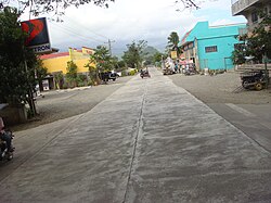 South Poblacion
 -
 Dinadiawan white beach (a long stretch of clean, fine, golden white sand coastline)
 -
 Rock formations along the shoreline (north of Baler along the Dicadi highway)
 -
 Ampere Beach and Ampere Rock in Dipaculao


References
[edit]- ^ Municipality of Dipaculao | (DILG)
- ^ "2015 Census of Population, Report No. 3 – Population, Land Area, and Population Density" (PDF). Philippine Statistics Authority. Quezon City, Philippines. August 2016. ISSN 0117-1453. Archived (PDF) from the original on May 25, 2021. Retrieved July 16, 2021.
- ^ a b c d Census of Population (2020). "Region III (Central Luzon)". Total Population by Province, City, Municipality and Barangay. Philippine Statistics Authority. Retrieved 8 July 2021.
- ^ "PSA Releases the 2021 City and Municipal Level Poverty Estimates". Philippine Statistics Authority. 2 April 2024. Retrieved 28 April 2024.
- ^ a b Municipality of Dipaculao website
- ^ National Historical Commission of the Philippines. "History of Baler". National Historical Commission of the Philippines. Archived from the original on 2019-09-16. Retrieved 2012-03-09.
When military district of El Príncipe was created in 1856, Baler became its capital. It was also made up of the settlements of San Jose de Casecnan (now the town of Maria Aurora), San Miguel de Dipaculao and Casiguran.
- ^ "The Brief History of Aurora". Archived from the original on 2023-11-05. Retrieved 2023-11-05.
- ^ Municipality of Dipaculao website: History (in Filipino)
- ^ a b Mesina, Ilovita. "Baler And Its People, The Aurorans". Aurora.ph. Archived from the original on 11 October 2023. Retrieved 21 February 2018.
- ^ Barrows, David P. (1910). "The Ilongot or Ibilao of Luzon". Popular Science Monthly. Vol. 77, no. 1–6. pp. 521–537.
- ^ Encyclopedia.com: Ilongot
- ^ Map of the Philippine Islands showing location of northern Tayabas as the present territory of Aurora in 1921:

- ^ Executive Order No. 375, s. 1950 (November 27, 1950), Organizing a portion of the municipality of Baler, province of Quezon, into an independent municipality under the name of Dipaculao, retrieved August 11, 2022
- ^ "History". Local Government of Dipaculao. Retrieved August 11, 2022.
 This article incorporates text from this source, which is in the public domain.
- ^ Republic Act No. 1761 (21 June 1957), "An Act Creating the Barrio of Laboy in the Municipality of Dipaculao, Province of Quezon", PhilippineLaw.info, archived from the original on 15 May 2012, retrieved 6 November 2016
- ^ Republic Act No. 1762 (21 June 1957), "RAn Act Creating the Barrio of Dinadiawan in the Municipality of Dipaculao, Province of Quezon", PhilippineLaw.info, archived from the original on 15 May 2012, retrieved 6 November 2016
- ^ Republic Act No. 1763 (21 June 1957), "An Act Creating the Barrio of Puangi in the Municipality of Dipaculao, Province of Quezon", PhilippineLaw.info, archived from the original on 15 May 2012, retrieved 6 November 2016
- ^ Republic Act No. 1764 (21 June 1957), "An Act Creating the Barrio of Dimabono in the Municipality of Dipaculao, Province of Quezon", PhilippineLaw.info, archived from the original on 15 May 2012, retrieved 6 November 2016
- ^ Republic Act No. 4809 (18 June 1966), "An Act Creating Certain Barrios in the Municipalities of Dipaculao and San Luis and the Municipal District of Dilasag, Province of Quezon", Chan Robles Virtual Law Library, archived from the original on 25 September 2013, retrieved 6 November 2016
- ^ "Province:". PSGC Interactive. Quezon City, Philippines: Philippine Statistics Authority. Retrieved 12 November 2016.
- ^ "Municipal: Dipaculao". PSGC Interactive. Quezon City, Philippines: Philippine Statistics Authority. Retrieved 8 January 2016.
- ^ a b Census of Population and Housing (2010). "Region III (Central Luzon)" (PDF). Total Population by Province, City, Municipality and Barangay. National Statistics Office. Retrieved 29 June 2016.
- ^ "Dipaculao, Aurora: Average Temperatures and Rainfall". Meteoblue. Retrieved 27 December 2018.
- ^ Census of Population (2015). "Region III (Central Luzon)". Total Population by Province, City, Municipality and Barangay. Philippine Statistics Authority. Retrieved 20 June 2016.
- ^ Censuses of Population (1903–2007). "Region III (Central Luzon)". Table 1. Population Enumerated in Various Censuses by Province/Highly Urbanized City: 1903 to 2007. National Statistics Office.
- ^ "Province of". Municipality Population Data. Local Water Utilities Administration Research Division. Retrieved 17 December 2016.
- ^ "Poverty incidence (PI):". Philippine Statistics Authority. Retrieved December 28, 2020.
- ^ "Estimation of Local Poverty in the Philippines" (PDF). Philippine Statistics Authority. 29 November 2005.
- ^ "2003 City and Municipal Level Poverty Estimates" (PDF). Philippine Statistics Authority. 23 March 2009.
- ^ "City and Municipal Level Poverty Estimates; 2006 and 2009" (PDF). Philippine Statistics Authority. 3 August 2012.
- ^ "2012 Municipal and City Level Poverty Estimates" (PDF). Philippine Statistics Authority. 31 May 2016.
- ^ "Municipal and City Level Small Area Poverty Estimates; 2009, 2012 and 2015". Philippine Statistics Authority. 10 July 2019.
- ^ "PSA Releases the 2018 Municipal and City Level Poverty Estimates". Philippine Statistics Authority. 15 December 2021. Retrieved 22 January 2022.
- ^ "PSA Releases the 2021 City and Municipal Level Poverty Estimates". Philippine Statistics Authority. 2 April 2024. Retrieved 28 April 2024.
- ^ "Masterlist of Schools" (PDF). Department of Education. January 15, 2021. Retrieved May 16, 2025.

External links
[edit]- Philippine Standard Geographic Code
- Dipaculao on Aurora.ph
Places adjacent to Dipaculao | |
|---|---|
| Municipalities | |
|---|---|
| Barangays | |