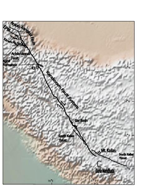
File:Karakorum fault superimposed on top of topographic map.pdf
Appearance

Size of this JPG preview of this PDF file: 463 × 599 pixels. Other resolutions: 185 × 240 pixels | 371 × 480 pixels | 593 × 768 pixels | 1,275 × 1,650 pixels.
Original file (1,275 × 1,650 pixels, file size: 431 KB, MIME type: application/pdf)
File history
Click on a date/time to view the file as it appeared at that time.
| Date/Time | Thumbnail | Dimensions | User | Comment | |
|---|---|---|---|---|---|
| current | 23:49, 1 December 2013 |  | 1,275 × 1,650 (431 KB) | Garrniel | Made all lines (names, faults, kinematics) bolder |
| 16:06, 14 November 2013 | No thumbnail | 0 × 0 (411 KB) | Garrniel | Increased name size of Achiehkopai fault | |
| 15:49, 14 November 2013 | No thumbnail | 0 × 0 (411 KB) | Garrniel | Increased object name sizes | |
| 20:12, 13 November 2013 | No thumbnail | 0 × 0 (408 KB) | Garrniel | User created page with UploadWizard |
File usage
The following page uses this file:
Global file usage
The following other wikis use this file:
- Usage on fr.wikipedia.org
- Usage on zh.wikipedia.org
