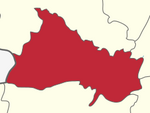
Hogenakkal, Dharmapuri
This article relies largely or entirely on a single source. (July 2020) |
Hogenakkal
ஒகேனக்கல் | |
|---|---|
Hamlet | |
| Coordinates: 12°07′15″N 77°46′40″E / 12.12083°N 77.77778°E | |
| Country | |
| State | Tamil nadu |
| District | Dharmapuri |
| Taluk | Pennagaram |
| Revenue block | Pennagaram |
| Named for | Nearby waterfalls |
| Languages | |
| • Official | Tamil |
| Time zone | UTC+5:30 (IST) |
| PIN | 636817 |
Hogenakkal is a hamlet in the Pennagaram taluk of Dharmapuri district, tamil name is Thalaineer aruvi(தலைநீர் அருவி). Ugunir Kal/Marikottayam in the Indian state of Tamil Nadu.[1]
Etymology
[edit]The hamlet of Hogenakkal shares its etymology with the nearby falls, deriving from the Kannada words 'hoge' and 'kall', meaning smoke and rock respectively. Hogenakkal basically means smoke over the rocks, referencing the appearance of the mist of the waterfalls.[2]
Geography
[edit]The hamlet is close to the confluence of the Kaveri and Chinnar rivers, just upstream of Hogenakkal Falls. It is near the Tamil Nadu-Karnataka border, which is partly formed by the Kaveri River. Hogenakkal is in the western part of Pennagaram revenue block, which is in the western extreme of both the taluk and the district. It is within part of Woddapatti reserved forest, at the western terminus of State Highway 60.[3]
See also
[edit]References
[edit]- ^ "Dharmapuri District Census Handbook (A)" (PDF). censusindia.gov.in. 2011. Retrieved 30 April 2021.
- ^ "Hogenakkal Waterfalls". www.karnatakatourism.org. 2020. Retrieved 10 September 2021.
- ^ "Dharmapuri District Map". dharmapuri.nic.in. 21 April 2021. Retrieved 30 April 2021.


