Hubbard, Minnesota
Appearance
Hubbard, Minnesota | |
|---|---|
| Coordinates: 46°50′12″N 95°0′37″W / 46.83667°N 95.01028°W | |
| Country | United States |
| State | Minnesota |
| County | Hubbard |
| Township | Hubbard |
| Area | |
• Total | 0.10 sq mi (0.26 km2) |
| • Land | 0.10 sq mi (0.26 km2) |
| • Water | 0.00 sq mi (0.00 km2) |
| Elevation | 1,416 ft (432 m) |
| Population (2020) | |
• Total | 56 |
| • Density | 565.66/sq mi (219.04/km2) |
| Time zone | UTC-6 (Central (CST)) |
| • Summer (DST) | UTC-5 (CDT) |
| ZIP Code | 56470 (Park Rapids) |
| Area code | 218 |
| FIPS code | 27-30320 |
| GNIS feature ID | 2806360[2] |
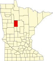
Hubbard is an unincorporated community and census-designated place (CDP) in the western part of Hubbard Township, Hubbard County, Minnesota, United States. It is in southern Hubbard County, along Minnesota State Highway 87, at the outlet of Long Lake. Park Rapids is 8 miles (13 km) to the northwest.
Hubbard was first listed as a CDP prior to the 2020 census.[2]
Demographics
[edit]References
[edit]- ^ "2020 U.S. Gazetteer Files". United States Census Bureau. Retrieved July 24, 2022.
- ^ a b c "Hubbard Census Designated Place". Geographic Names Information System. United States Geological Survey, United States Department of the Interior.
- ^ "Census of Population and Housing". Census.gov. Retrieved June 4, 2016.


