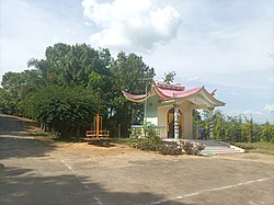
Kakching district
This article needs additional citations for verification. (December 2016) |
Kakching district
(Meitei: /kək.ciŋ/) | |
|---|---|
 | |
 Location in Manipur | |
| Coordinates: 24°29′N 93°59′E / 24.48°N 93.98°E | |
| Country | |
| State | Manipur |
| Headquarter | Kakching |
| Area | |
• Total | 190 km2 (70 sq mi) |
| • Rank | 16 |
| Population (2011) | |
• Total | 135,481 |
| • Density | 710/km2 (1,800/sq mi) |
| Language(s) | |
| • Official | Meitei (officially called Manipuri)[1] |
| Time zone | UTC+5:30 (IST) |
| Vehicle registration | MN04 |
| Website | kakching |
Kakching district (Meitei pronunciation:/kək.ciŋ/) is one of the 16 districts of Manipur state in northeastern India. It was formedin 2016 from Thoubal district, prior to which it was a subdivision of the latter.[2][3] The Kakching district is bounded by Thoubal district on the north, Ukhrul and Chandel districts on the east, Churchandpur and Bishnupur districts on the south and Imphal West and Imphal East districts on the west.
History
[edit]On 8 December 2016, this district came into existence when all its administrative units of the erstwhile Kakching sub-division were transferred to form a new district. Later, Kakching District was divided into two sub-divisions namely, Kakching and Waikhong.
Demographics
[edit]At the time of the 2011 census, Kakching district had a population of 135,481. Kakching had a sex ratio of 1003 females per 1000 males. 35.91% of the population lived in urban areas. Scheduled Castes and Scheduled Tribes made up 29.05% and 0.85% of the population respectively.[5]
Languages
[edit]At the time of the 2011 census, 96.57% of the population spoke Manipuri and 1.17% Nepali as their first language.[6]
Rivers and lakes
[edit]The Sekmai river is the most significant river flow in the district.
Tourism
[edit]Kakching Garden is situated at Uyok Ching, in the south of Kakching Bazaar. It is one of the most highly rated gardens in Manipur.[according to whom?]
A fishery farm is located in the northern hills of Kakching near the Kakching Lamkhai.
Administrative divisions
[edit]The district is divided into two sub-divisions:
The four Vidhan Sabha constituencies located within the undivided district are Kakching, Hiyanglam, Sugnu and Wabagai.
Kakching is a municipal town and Waikhong, Hiyanglam, and Sugnu are other small towns in the district.
Th.Kirankumar IAS is the first DC of Kakching district appointed by the Government of Manipur on 8 December 2016 and S.Goutam Singh, IPS is the first Superintendent of Police of Kakching district.
See also
[edit]References
[edit]- ^ "Report of the Commissioner for linguistic minorities: 47th report (July 2008 to June 2010)" (PDF). Commissioner for Linguistic Minorities, Ministry of Minority Affairs, Government of India. p. 78. Archived from the original (PDF) on 13 May 2012. Retrieved 16 February 2012.
- ^ Khelen Thokchom, More districts in Manipur, The Telegraph (Kolkata), 9 December 2016. ProQuest 2290178396
- ^ "Manipur Gazette No 408 dated 9 December 2016" (PDF). Archived from the original (PDF) on 21 April 2017. Retrieved 20 April 2017.
- ^ "Table C-01 Population by religious community: Manipur". Census of India. Registrar General and Census Commissioner of India. 2011.
- ^ "District Census Hand Book - Thoubal" (PDF). Census of India. Registrar General and Census Commissioner of India.
- ^ a b "Table C-16 Population by mother tongue: Manipur". Census of India. Registrar General and Census Commissioner of India. 2011.
