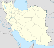
Larestan Ayatollah Ayatollahi International Airport
Appearance
(Redirected from Larestan International Airport)
Larestan International Airport | |||||||||||
|---|---|---|---|---|---|---|---|---|---|---|---|
 | |||||||||||
| Summary | |||||||||||
| Airport type | Public | ||||||||||
| Owner | Government of Iran | ||||||||||
| Operator | Iran Airports Company | ||||||||||
| Location | Lar, Fars, Iran | ||||||||||
| Elevation AMSL | 2,625 ft / 800 m | ||||||||||
| Coordinates | 27°40′23″N 54°22′53″E / 27.67306°N 54.38139°E | ||||||||||
| Map | |||||||||||
 | |||||||||||
| Runways | |||||||||||
| |||||||||||
| Statistics (2017) | |||||||||||
| |||||||||||
Source: Iran Airports Company[1] | |||||||||||
Larestan International Airport (Persian: فرودگاه بینالمللی لارستان) (IATA: LRR, ICAO: OISL) is an airport near Lar, Iran.
Introduction
[edit]The airport began operations in 1983, although much of its destinations were domestic. After the Persian Gulf War, it became an international airport with its first international flight to Dubai, UAE.[citation needed]


Airlines and destinations
[edit]| Airlines | Destinations |
|---|---|
| Air Arabia | Abu Dhabi (suspended), Sharjah[2] |
| Chabahar Airlines | Tehran–Mehrabad |
| flydubai | Dubai–International |
| Iran Air | Doha, Kuwait City, Tehran–Mehrabad |
| Qeshm Air | Dubai–International, Tehran–Mehrabad |
References
[edit]- ^ "Traffic Figures". Retrieved 14 February 2018.[permanent dead link]
- ^ "AIR ARABIA RESUMES SHARJAH – LAR SERVICE FROM APRIL 2023". 21 April 2023.
See also
[edit]

