Portal:Tropical cyclones
The Tropical Cyclones Portal

A tropical cyclone is a storm system characterized by a large low-pressure center, a closed low-level circulation and a spiral arrangement of numerous thunderstorms that produce strong winds and heavy rainfall. Tropical cyclones feed on the heat released when moist air rises, resulting in condensation of water vapor contained in the moist air. They are fueled by a different heat mechanism than other cyclonic windstorms such as Nor'easters, European windstorms and polar lows, leading to their classification as "warm core" storm systems. Most tropical cyclones originate in the doldrums, approximately ten degrees from the Equator.
The term "tropical" refers to both the geographic origin of these systems, which form almost exclusively in tropical regions of the globe, as well as to their formation in maritime tropical air masses. The term "cyclone" refers to such storms' cyclonic nature, with anticlockwise rotation in the Northern Hemisphere and clockwise rotation in the Southern Hemisphere. Depending on its location and intensity, a tropical cyclone may be referred to by names such as "hurricane", "typhoon", "tropical storm", "cyclonic storm", "tropical depression" or simply "cyclone".
Types of cyclone: 1. A "Typhoon" is a tropical cyclone located in the North-west Pacific Ocean which has the most cyclonic activity and storms occur year-round. 2. A "Hurricane" is also a tropical cyclone located at the North Atlantic Ocean or North-east Pacific Ocean which have an average storm activity and storms typically form between May 15 and November 30. 3. A "Cyclone" is a tropical cyclone that occurs in the South Pacific and Indian Oceans.
Selected named cyclone -
Hurricane Ida was a deadly and extremely destructive tropical cyclone in 2021 that became the second-most damaging and intense hurricane to make landfall in the U.S. state of Louisiana on record, behind Hurricane Katrina in 2005. In terms of maximum sustained winds at landfall (150 mph or 240 km/h), Ida tied 2020's Hurricane Laura and the 1856 Last Island hurricane as the strongest on record to hit Louisiana. The remnants of the storm also caused a tornado outbreak and catastrophic flooding across the Northeastern United States. The ninth named storm, fourth hurricane, and second major hurricane of the 2021 Atlantic hurricane season, Ida originated from a tropical wave in the Caribbean Sea on August 23. On August 26, the wave developed into a tropical depression, which organized further and became Tropical Storm Ida later that day, near Grand Cayman. Amid favorable conditions, Ida intensified into a hurricane on August 27, just before moving over western Cuba. A day later, the hurricane underwent rapid intensification over the Gulf of Mexico, and reached its peak intensity as a strong Category 4 hurricane while approaching the northern Gulf Coast, with maximum sustained winds of 150 mph (240 km/h) and a minimum central pressure of 929 millibars (27.4 inHg). On August 29, the 16th anniversary of Hurricane Katrina making landfall, Ida made landfall near Port Fourchon, Louisiana, devastating the town of Grand Isle. Ida weakened steadily over land, becoming a tropical depression on August 30, as it turned northeastward. On September 1, Ida transitioned into a post-tropical cyclone as it accelerated through the Northeastern United States, breaking multiple rainfall records in various locations before moving out into the Atlantic on the next day. Afterward, Ida's remnant moved into the Gulf of St. Lawrence and stalled there for a couple of days, before being absorbed into another developing low-pressure area early on September 5.
The precursor to Ida caused catastrophic and deadly flash flooding in Venezuela. Ida knocked down palm trees and destroyed many homes in Cuba during its brief passage over the country. Throughout its path of destruction in Louisiana, more than a million people in total had no electrical power. Widespread heavy infrastructural damage occurred throughout the southeastern portion of the state, as well as extremely heavy flooding in coastal areas. New Orleans' levees survived (unlike during Katrina), though power line damage was extensive throughout the whole city. There was also substantial plant destruction in the state. Numerous tornadoes were spawned by Ida as it moved over the Eastern United States. The remnants of the storm produced unexpectedly severe damage in the Northeastern United States on September 1–2. Several intense tornadoes and catastrophic flash flooding swept through the entire region, which had already been impacted by several tropical cyclones, Elsa, Fred, and Henri during July and August. The flooding in New York City prompted the shutdown of much of the transportation system. (Full article...)
Selected article -
The meteorological history of Hurricane Gustav spanned eleven days, from August 25 to September 4, 2008. The tropical disturbance which eventually spawned Hurricane Gustav gathered on August 16, southwest of the Cape Verde islands, but was slow to develop as it trekked west across the Atlantic. Upon reaching the warm waters of Caribbean Sea it began to organize and became a tropical depression on August 25. It quickly strengthened to a tropical storm, and then a hurricane, before making landfall on Haiti's southwest peninsula. Gustav was severely disrupted by Hispaniola's mountains and stalled, disorganized, in the Gulf of Gonâve between August 26 and 27.
Deep convection reformed the storm's center southwest of Haiti, near Jamaica's east coast. Under the influence of a mid-level ridge that extended from the Gulf of Mexico to the western Atlantic Ocean, Gustav picked up a westward motion. It was briefly disrupted by Jamaica as it passed over the mountainous island but rapidly strengthened when it moved over open water once again. Reaching Category 4 strength about 24 hours after having been upgraded to a hurricane, Gustav brushed the Isle of Youth and made landfall on Cuba's western's peninsula. (Full article...)
Selected image -

Selected season -

The 2005 Atlantic hurricane season was a record-breaking, devastating and deadly Atlantic hurricane season. It is the second-costliest hurricane season, just behind the 2017 season. It featured 28 tropical and subtropical storms, which was the most recorded in a hurricane season until the 2020 season. The United States National Hurricane Center named 27 storms, exhausting the annual pre-designated list, requiring the use of six Greek letter names, and adding an additional unnamed subtropical storm during a post-season re-analysis. A record 15 storms attained hurricane status, with maximum sustained winds of at least 74 miles per hour (119 km/h). Of those, a record seven became major hurricanes, rated Category 3 or higher on the Saffir–Simpson scale. Four storms of this season became Category 5 hurricanes, the most of any season on record.
The four Category 5 hurricanes during the season were: Emily, Katrina, Rita, and Wilma. In July, Emily reached peak intensity in the Caribbean Sea, becoming the first Category 5 hurricane of the season, later weakening and striking Mexico twice. It was the first Category 5 hurricane recorded in the month of July and was the earliest-forming Category 5 hurricane on record, until Hurricane Beryl surpassed the record in July 2024. In August, Katrina reached peak winds in the Gulf of Mexico but weakened by the time it struck the U.S. states of Louisiana and Mississippi. The most devastating effects of the season were felt on the Gulf Coast of the United States, where Katrina's storm surge crippled New Orleans, Louisiana, for weeks and devastated the Mississippi coastline. Katrina became the costliest U.S. hurricane, leaving $125 billion in damage and 1,392 deaths. Rita followed in September, reaching peak intensity in the Gulf of Mexico before weakening and hitting near the border of Texas and Louisiana. The season's strongest hurricane, Wilma, became the most intense Atlantic hurricane on record, as measured by barometric pressure. Lasting for ten days in October, Wilma moved over Cozumel, the Yucatán Peninsula, and Florida, causing over $22 billion in damage and 52 deaths. (Full article...)
Related portals
Currently active tropical cyclones

Italicized basins are unofficial.
- North Atlantic (2025)
- No active systems
- West Pacific (2025)
- No active systems
- Mediterranean (2024–25)
- No active systems
- South-West Indian Ocean (2024–25)
- No active systems
- Australian region (2024–25)
- No active systems
- South Pacific (2024–25)
- No active systems
- South Atlantic (2024–25)
- No active systems
Last updated: 19:07, 29 May 2025 (UTC)
Tropical cyclone anniversaries

May 29
- 1958 - Typhoon Phyllis reached its peak intensity with 295 km/h (185 mph) winds, becoming the strongest typhoon ever recorded in the month of May.
- 1963 - A powerful cyclone struck what is now Bangladesh, killing 11,520&bsp;people.
- 2016 - Tropical Storm Bonnie (pictured) made landfall as a tropical depression over South Carolina. Bonnie brought heavy rainfall to the Southeastern United States, causing only US$640,000 in damages.

May 30
- 1959 - Tropical Storm Arlene made landfall in Louisiana as a minimal tropical storm, causing $500,000 worth of damage in the Southeastern United States.
- 2008 - Tropical Storm Alma (pictured) affects much of Central America with torrential rainfall. Four people died while seven people remained missing from the storm. Damages were estimated to be about US$35 million.
- 2022 - Hurricane Agatha hit the Mexican state of Oaxaca, becoming the strongest hurricane in the country in the month of May.

May 31
- 1997 - Typhoon Marie reached its peak intensity with winds of 165 km/h (105 mph) in the open Pacific Ocean. Marie did not affect land.
- 2008 - Tropical Storm Arthur (pictured) makes landfall over Belize. Damages were estimated to be around US$78 million due to extensive rainfall.
Did you know…


- …that the Joint Typhoon Warning Center considers that Typhoon Vera (pictured) of 1986 is actually two distinct systems, formed from two separated low-level circulations?
- …that Cyclone Freddy (track pictured) in 2023 was the longest-lasting tropical cyclone recorded?
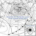
- …that the typhoons of 2024—Yinxing, Toraji, Usagi, and Man-yi (pictured)—made history as the first recorded instance since 1951 of four tropical cyclones coexisting in November?
- …that Hurricane Otis (pictured) in 2023 was the first Pacific hurricane to make landfall at Category 5 intensity and surpassed Hurricane Patricia as the strongest landfalling Pacific hurricane on record?
General images -

Category 2 is the fourth-highest classification on the Saffir–Simpson hurricane wind scale, and categorizes tropical cyclones with 1-minute maximum sustained winds between 83 and 95 knots (96 and 109 mph; 154 and 176 km/h; 43 and 49 m/s). Tropical cyclones that strengthen to Category 2 status and make landfall are capable of causing severe damage to human lives and infrastructure. As of 2022, a total of 89 hurricanes have peaked at Category 2 intensity within the Northeast Pacific basin, which is defined as the region of the Pacific Ocean north of the equator and east of the International Date Line. Collectively, 1,775 people have been killed as a result of Category 2 Pacific hurricanes. Storms that also attained Category 3, 4, or 5 status on the scale are not included.
There is a plethora of factors that influence tropical cyclogenesis, the formation of tropical cyclones, in the Northeastern Pacific. The North Pacific High and Aleutian Low, which occur from December to April, produce strong upper-level winds which prevents the formation of tropical cyclones. During the summer and early autumn months, sea surface temperatures are generally warm enough to support tropical cyclone development in the Northeast Pacific, and perhaps even rapid intensification. Additionally, El Niño events cause more powerful hurricanes to form by generating weaker wind shear and higher sea surface temperatures, while La Niña events reduce the number of such hurricanes by doing the opposite. (Full article...)
Topics
Subcategories
Related WikiProjects
WikiProject Tropical cyclones is the central point of coordination for Wikipedia's coverage of tropical cyclones. Feel free to help!
WikiProject Weather is the main center point of coordination for Wikipedia's coverage of meteorology in general, and the parent project of WikiProject Tropical cyclones. Three other branches of WikiProject Weather in particular share significant overlaps with WikiProject Tropical cyclones:
- The Non-tropical storms task force coordinates most of Wikipedia's coverage on extratropical cyclones, which tropical cyclones often transition into near the end of their lifespan.
- The Floods task force takes on the scope of flooding events all over the world, with rainfall from tropical cyclones a significant factor in many of them.
- WikiProject Severe weather documents the effects of extreme weather such as tornadoes, which landfalling tropical cyclones can produce.
Things you can do
 |
Here are some tasks awaiting attention:
|
Wikimedia
The following Wikimedia Foundation sister projects provide more on this subject:
-
Commons
Free media repository -
Wikibooks
Free textbooks and manuals -
Wikidata
Free knowledge base -
Wikinews
Free-content news -
Wikiquote
Collection of quotations -
Wikisource
Free-content library -
Wikiversity
Free learning tools -
Wikivoyage
Free travel guide -
Wiktionary
Dictionary and thesaurus


