Pensaukee River
Appearance
| Pensaukee River Pensaukie River | |
|---|---|
 Flooding on the Pensaukee River near its mouth at Green Bay. | |
| Location | |
| Country | United States |
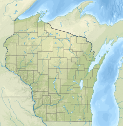
| State | Wisconsin |
| Physical characteristics | |
| Source | East of Bonduel |
| • coordinates | 44°44′37″N 88°24′37″W / 44.7436022°N 88.4103799°W |
| Mouth | Green Bay |
• location | Pensaukee |
• coordinates | 44°49′21″N 87°54′06″W / 44.8224914°N 87.9017697°W |
• elevation | 584 ft (178 m) |
| Basin features | |
| Tributaries | |
| • left | Spring Creek, North Branch Pensaukee River |
| • right | Brookside Creek |
The Pensaukee River is a river located in northeastern Wisconsin.[1] It is a tributary of Lake Michigan via Green Bay.[2]
Route
[edit]The river is 47 miles (76 km) long.[3] Its southern branch rises from Pautz Lake in Shawano County and northern branch originates in Pensaukee Lakes in Shawano County.[2] It passes near the communities of Krakow, Klondike, Abrams, and its mouth empties into Green Bay near Pensaukee.[2]
Drainage basin
[edit]Its drainage basin covers Oconto County and Shawano County, Wisconsin.[2] The watershed covers 160 square miles (410 km2) of area.[3] 61% of land in the drainage basin has agricultural use.[4]
References
[edit]- ^ "Pensaukee River". Geographic Names Information System. United States Geological Survey, United States Department of the Interior. Retrieved October 7, 2020.
- ^ a b c d "Advanced Viewer". viewer.nationalmap.gov. National Map. Retrieved September 21, 2020.
- ^ a b "Upper Green Bay Basin Integrated Management Plan" (pdf). Wisconsin Department of Natural Resources. 2001. p. 23. Retrieved September 21, 2020.
- ^ "Upper Green Bay Basin Integrated Management Plan" (pdf). Wisconsin Department of Natural Resources. 2001. p. 77. Retrieved September 21, 2020.


