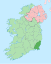
Rathangan, County Wexford
Appearance
This article needs additional citations for verification. (October 2021) |
Rathangan
Ráth Daingean | |
|---|---|
Village | |
 Church of The Assumption and St. Laurence O'Toole, Rathangan | |
| Coordinates: 52°13′41″N 6°36′32″W / 52.228°N 6.609°W | |
| Country | Ireland |
| Province | Leinster |
| County | Wexford |
| Time zone | UTC+0 (WET) |
| • Summer (DST) | UTC-1 (IST (WEST)) |
| Area code | 051 |
Rathangan (Irish: Ráth Daingean, meaning 'ringfort fortress')[1] is a small village located in the south of County Wexford, in Ireland.
Details
[edit]It has a size of approximately 1,866 square metres. It contains a primary school and a pub called Rathangan Bar, which also contains a restaurant and takeaway. Rathangan also contains a Roman Catholic church, which dates from 1873. Rathangan Hall, a local community hall, hosts after-school activities. There is a graveyard at the corner. As of May 2015, the school had nearly 300 pupils.[citation needed] It is in the Duncormick area. Rathangan contains a GAA club, three pitches and an completed astro-turf.[citation needed]
See also
[edit]References
[edit]- ^ "Ráth Daingean/Rathangan". Placenames Database of Ireland (logainm.ie). Retrieved 19 October 2021.


