Roaring River State Park
| Roaring River State Park | |
|---|---|
 Fish hatchery at Roaring River State Park | |
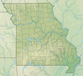
| Location | Barry County, Missouri, United States |
| Coordinates | 36°35′29″N 93°49′54″W / 36.59139°N 93.83167°W[1] |
| Area | 4,820.68 acres (1,950.86 ha)[2] |
| Elevation | 1,188 ft (362 m)[1] |
| Established | 1928[3] |
| Administered by | Missouri Department of Natural Resources |
| Visitors | 1,130,496 (in 2023)[2] |
| Website | Official website |
Roaring River State Park is a public recreation area covering of 4,294 acres (1,738 ha) eight miles (13 km) south of Cassville in Barry County, Missouri. The state park offers trout fishing on the Roaring River, hiking on seven different trails, and the seasonally open Ozark Chinquapin Nature Center.[4]
History
[edit]Land for the park was originally donated by Thomas Mark “Doc” Sayman, a medicine-show man who made millions peddling patent medicines and soaps during his traveling tent shows in the early 20th century.[5] When Sayman failed to get the game and fish commission to buy property at Roaring River Spring, he purchased 2,400 acres which he then turned over to the state.[4] The original park was acquired in 1923, and developed between 1933 and 1939 by the Civilian Conservation Corps and Works Progress Administration.[6]
Historic sites
[edit]The park includes several resources dating from the 1930s that were listed on the National Register of Historic Places in 1985 and that are also included in the Emergency Conservation Work (E.C.W.) Architecture in Missouri State Parks, 1933-1942, Thematic Resources.[6]
- Bath House (NRIS 85000500): The clubhouse (or bath house) was built between 1936 and 1938, and is a rambling one-story, rustic stone building. It has a curvilinear section and a gable roof. It is the last surviving structure in a lake and beach development project initiated, but never completed, by the Civilian Conservation Corps (CCC).[7]: 393
- Camp Smokey/Company 1713 Historic District (NRIS 85000513): This historic district encompasses three buildings and one structure that were part of the central compound of the CCC installation. They were erected in 1933 and are the Outdoor Fireplace/Chimney, Barracks No. 2 (Foreman's Quarters), Barracks #3 (Hospital), and Barracks #4 (Education and Supply Building).[7]: 364
- Dam/Spillway (NRIS 85000518): The original stone and earthen dam was built in 1865 by William McClure to power McClure's Mill (destroyed c. 1920). The dam was reconstructed by the CCC in 1933 for an important fish hatchery complex.[7]: 388
- Deer Leap Trail (NRIS 85000519): It was built between 1933 and 1939 by the CCC, and is a man-made trail, approximately 3/10 of a mile in length. It has rough stone steps and stone retaining walls and features the Deer Leap Overlook.[7]: 378
- Honeymoon Cabin (NRIS 85000520): Also known as Cabin #26, it is a small (15 feet by 23 feet) rectangular rustic cottage with an enclosed front porch in a secluded location. It was built between 1933 and 1939 by the CCC, and has a cross-gable roof, board-and-batten siding, and a stone foundation.[7]: 373
- Hotel (NRIS 85000501): Also known as the Lodge, it is a three-story, native stone and wood rectangular building with a full-length second-story porch. It was built in 1938 by CCC and Works Progress Administration relief workers.[7]: 340
- Shelter Kitchen No. 2 and Rest Room (NRIS 85000521): The Shelter Kitchen No. 2, or Shelter House, was built by the CCC in 1934, and is a rustic log structure with a flagstone floor and side-gable roof. The stone rest room is a small rectangular building with a front gable roof.[7]: 382
References
[edit]- ^ a b "Roaring River Spring". Geographic Names Information System. United States Geological Survey, United States Department of the Interior.
- ^ a b "Data Sheet: Roaring River State Park" (PDF). Missouri Department of Natural Resources. Retrieved January 2, 2024.
- ^ "State Park Land Acquisition Summary". Missouri State Parks. August 25, 2011. Retrieved May 5, 2018.
- ^ a b "Roaring River State Park". Missouri Department of Natural Resources. December 10, 2010. Retrieved September 9, 2014.
- ^ Sexton, Jimmy (August 5, 2015). ""Doc" Sayman was a friend to nature". River Hills Traveler. Retrieved May 5, 2018.
- ^ a b Denny, James M.; Wright, Bonita Marie (November 7, 1984). "Emergency Conservation Work (ECW) Architecture in Missouri State Parks, 1933-1942, Thematic Resources". NPGallery. National Park Service. Retrieved January 2, 2025.
- ^ a b c d e f g Denny, James M.; Wright, Bonita Marie (November 7, 1984). "Emergency Conservation Work (ECW) Architecture in Missouri State Parks, 1933-1942, Thematic Resources" (PDF). Missouri Department of Natural Resources. National Register of Historic Places Inventory Nomination Form (includes photographs}. p. 363–402. Retrieved January 2, 2025.
External links
[edit]- Roaring River State Park Missouri Department of Natural Resources
- Roaring River State Park Map Missouri Department of Natural Resources
- State parks of Missouri
- State parks of the U.S. Interior Highlands
- Protected areas of Barry County, Missouri
- Protected areas established in 1928
- 1928 establishments in Missouri
- Nature centers in Missouri
- Civilian Conservation Corps in Missouri
- Works Progress Administration in Missouri
- Historic districts on the National Register of Historic Places in Missouri
- Park buildings and structures on the National Register of Historic Places in Missouri
- Buildings and structures in Barry County, Missouri
- National Register of Historic Places in Barry County, Missouri


