Stainsacre
Appearance
| Stainsacre | |
|---|---|
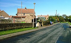
 Road in the village | |
Location within North Yorkshire | |
| OS grid reference | NZ915085 |
| Civil parish | |
| Unitary authority | |
| Ceremonial county | |
| Region | |
| Country | England |
| Sovereign state | United Kingdom |
| Post town | WHITBY |
| Postcode district | YO22 |
| Police | North Yorkshire |
| Fire | North Yorkshire |
| Ambulance | Yorkshire |
| UK Parliament | |
Stainsacre is a village in the civil parish of Hawsker-cum-Stainsacre in North Yorkshire on the edge of the North York Moors National Park. It lies 2 miles (3.2 km) south-east of Whitby, near the A171 road.[1]
The village's population in 1809 was 144.[2]
Stainsacre was the seat of Jonathan Sanders, a merchant.[3] By 1884, W.H. Attley lived in Stainsacre Hall.[4] Stainsacre Hall was owned by Middlesbrough Borough Council and they used it as an educational and activity centre until 2010, before it was sold due to cost and dwindling numbers attending.[5]
Hawsker railway station served Stainsacre until it closed in 1965.
The Parish Church is dedicated to All Saints.
See also
[edit]References
[edit]- ^ "Genuki: Whitby Supplementary, Yorkshire (North Riding)". genuki.org.uk. Retrieved 28 February 2024.
- ^ Thomas Langdale (1809). A topographical dictionary of Yorkshire (1 ed.). J Langdale. p. 69.
- ^ Thomas Langdale (1822). A topographical dictionary of Yorkshire (2 ed.). J Langdale. p. 109.
- ^ Thomas N. Bradley (1884). Bradley's new guide to Whitby. p. 39.
- ^ McKenzie, Sandy (2 October 2010). "Stainsacre outdoor centre to close". Gazette Live. Retrieved 22 December 2015.
External links
[edit]![]() Media related to Stainsacre at Wikimedia Commons
Media related to Stainsacre at Wikimedia Commons

