Templin station
Appearance
| Bf | |||||||||||
 2014 | |||||||||||
| General information | |||||||||||
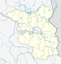
| Location | Zehdenicker Straße 1 17268 Templin Brandenburg Germany | ||||||||||
| Coordinates | 53°06′44″N 13°29′28″E / 53.1122°N 13.4911°E | ||||||||||
| Owned by | DB Netz | ||||||||||
| Operated by | DB Station&Service | ||||||||||
| Line(s) | |||||||||||
| Platforms | 1 side platform | ||||||||||
| Tracks | 2 | ||||||||||
| Train operators | Niederbarnimer Eisenbahn | ||||||||||
| Other information | |||||||||||
| Station code | 6167 | ||||||||||
| DS100 code | WT[1] | ||||||||||
| IBNR | 8010347 | ||||||||||
| Category | 7[2] | ||||||||||
| Fare zone | VBB: 4157[3] | ||||||||||
| Website | www.bahnhof.de | ||||||||||
| History | |||||||||||
| Opened | 1 May 1888 | ||||||||||
| Services | |||||||||||
| |||||||||||
 | |||||||||||
Templin station is a railway station in the municipality of Templin, located in the Uckermark district in Brandenburg, Germany.
References
[edit]- ^ Eisenbahnatlas Deutschland (German railway atlas) (2017 ed.). Schweers + Wall. 2017. ISBN 978-3-89494-146-8.
- ^ "Stationspreisliste 2025" [Station price list 2025] (PDF) (in German). DB Station&Service. 28 November 2024. Retrieved 5 December 2024.
- ^ "Der VBB-Tarif: Aufteilung des Verbundgebietes in Tarifwaben und Tarifbereiche" (PDF). Verkehrsbetrieb Potsdam. Verkehrsverbund Berlin-Brandenburg. 1 January 2017. Retrieved 12 December 2019.

