Thorness Bay
| Site of Special Scientific Interest | |
 Thorness Bay looking southwest | |
| Location | Isle of Wight |
|---|---|
| Grid reference | SZ455935 |
| Coordinates | 50°44′30″N 1°21′21″W / 50.7416°N 1.3557°W |
| Interest | Biological and Geological |
| Area | 213 acres (86.2 ha) |
| Notification | 1966 |

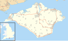
Thorness Bay is an 213-acre (86.2-hectare) Site of special scientific interest which is located on the north-west coast of the Isle of Wight, England, in the western arm of the Solent. The site was notified in 1966 for both its biological and geological features. The bay stretches about 2 miles (3.2 km) from Salt Mead Ledge in the west to Gurnard Head Nr. Gurnard Bay to the east.
The sea bed is a mixture of mud, sand and shingle with rocky outcrops of Bembridge Limestone. The soft cliffs of the bay contain the Bembridge Insect Bed, where fossilized plants and insects have been discovered. Over 200 insect species have been recorded in this area.[1][2]
A small unnamed brook enters the sea in the middle of the bay after passing through a marsh.
Little Thorness Farm, a beef farm near the bay has 18 acres (7.3 ha) of protected marshland under stewardship and is a SSSI because it is home to wildlife not found in other areas.
Holiday Park
[edit]Thorness Bay also has a holiday park run by Parkdean Resorts. It has a direct footpath leading straight to the beach.[3]
References
[edit]- ^ "Site Name: Thorness Bay SSSI" (PDF). www.english-nature.org.uk. Archived from the original (PDF) on 3 March 2016.
- ^ "Thorness Bay". UK Fossils Network. 29 July 2010.
- ^ "Thorness Bay Holiday Park". Parkdean Resorts.

