Tweed Valley Forest Park
Appearance
| Tweed Valley Forest Park | |
|---|---|
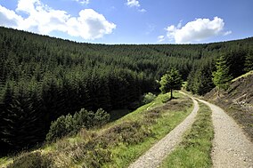
 Glentress Forest | |
 The location of the Tweed Valley Forest Park in southern Scotland (in red, other forests parks shown in green). | |
| Location | Scottish Borders, Scotland |
| Coordinates | 55°41′N 3°08′W / 55.683°N 3.133°W |
| Area | 6,365 ha (24.58 sq mi)[1] |
| Established | 2002[2] |
| Governing body | Forestry and Land Scotland |
| Website | Tweed Valley Forest Park |
Tweed Valley Forest Park is forest park in the border region of Scotland. It consists of a network of eight forests managed by Forestry and Land Scotland (FLS) spread along the valley of the River Tweed,[3] and which are managed with an emphasis on recreational facilities for visitors.[4]
The forest park was established in 2002,[2] and covers 64 square kilometres (25 sq mi).[1]
At each location there is a car park and waymarked trails for visitors. Some of the site have more facilities, such as toilets and mountain bike trails.[5] The eight forests are:[3]
- Caberston
- Cademuir
- Cardrona
- Glenkinnon
- Glentress - also part of the 7stanes network of mountain bike centres
- Innerleithen - also part of the 7stanes network of mountain bike centres
- Thornielee
- Yair
References
[edit]- ^ a b "National Forest Estate Forest Parks GB". Scottish Government Spatial Data Infrastructure. 21 September 2017. Retrieved 14 May 2018.
- ^ a b "Dumfries and Borders District Strategic Plan 2009-2013" (PDF). Forest Enterprise Scotland. p. 16. Retrieved 10 February 2019.
- ^ a b "Tweed Valley Forest Park". Forestry and Land Scotland. Retrieved 9 April 2019.
- ^ "Other national designations". Scottish Natural Heritage. Retrieved 3 May 2018.
- ^ "Tweed Valley Forest Park Map" (PDF). Forestry and Land Scotland. Retrieved 9 April 2019.
External links
[edit]- Tweed Valley Forest Park - Forestry and Land Scotland
